Showing posts with label adventure. Show all posts

Friday, April 27, 2018

David English and Twin Ponds Cut-Off Trail


Location: White Clay Creek State Park, Newark, Delaware
Season Visited: Spring
Trail Length: David English Trail is 2.4 miles long. If you make it a shorter loop from the park office by taking the Twin Ponds Cut-Off Trail, I estimate the hike to be about 1.6 miles. The cut-off trail itself is 0.4 miles. You can see the layout of the trail (and other trails in the park) on this map.
Time to Hike: Hiking the full David English Trail took us about 2 hours, going at a toddler's pace some of the way. Doing the short loop via the cut-off trail when said toddler was a small baby took us 1.5 hours.
Difficulty Level: Moderately easy.

I have written before about trails in White Clay Creek State Park. This post is actually two posts in one, as I have hiked this trail twice now. The first time was in May 2017 when my son was three months old. The first part of this post and the accompanying pictures are from that hike. The goal that day was to hike the entire David English Trail, but the baby was not having it and we ended up taking the cut-off trail to make a shorter loop back to our car. The second time was a couple of weeks ago, the beginning of April, with a much more adventurous 14-month-old! This park is close and pretty and has easy hikes - perfect for a new mom or families with young children. The David English Trail in particular is a good choice because you can decide at the halfway point whether you want the hike to be short or a bit longer depending on how your family is feeling. Be warned: on a warm April day you will have to get out of the way of a LOT of bikers.

Both times, in addition to my son, I went with my husband and sister to the hike, which starts at a trailhead at the following coordinates, near a park office:


One nice thing about the White Clay Creek trail markers is that they include coordinates!

As you can see on the map, the trail has three different ways you can go almost immediately. We decided to go left here. This put us directly on the David English Trail, walking on relatively level ground. Going right would also have put us on the David English Trail, but there looked to be an incline, and we decided to go easy on ourselves since this was only my second-ever hike with the baby back in 2017. What followed was a mostly flat dirt trail.


With the newest addition!

My sister is obviously highly enjoying her quality time with nature.


Further on we came to a bench, where I fed the baby and let him chill out of the carrier for a while. At the time I was experiencing quite a bit of difficulty hiking with him because he did not like the carrier under most circumstances. Now that he can sit in a backpack - or walk - he has taken to hiking with joy.

It was only a year ago, but he looks so much smaller than he does now, as you will see!


Here you can see how the trail looks in April from our most recent trip:

There is much less foliage in April. This is the trail just past the parking lot.

Past the bench the trail opens up, coming to a sweet little pond filled with turtles, and where we spotted many small birds. Both times I've been to this pond I've seen eastern bluebirds. After the pond, the trail meanders back into the woods. Near the end it becomes a bit more steep, and you do have to put in a bit of effort, especially if carrying a toddler on your back. It's never difficult, however. In season you can see a lovely magnolia tree blooming near the park office before returning to the parking lot. These pictures are from the April 2018 trip.

My sister and dog.

Baby boy loves hanging out in the Osprey carrier.


Conked out.

I was very happy to be able to complete the trail this time around. A successful hike with my son has definitely renewed my confidence as I begin to hike more often with him. I can't wait to share more of our adventures with you.

Monday, January 19, 2015

Overall Run and Beecher Ridge

Location: Shenandoah National Park, VA
Season Visited: Fall
Trail Length: 12 miles (about six miles each day for two days)
Time to Hike: 2 days
Difficulty Level: Day 1 - 4.  Day 2 - 5.

I successfully completed my first solo backpacking trip back in October in - where else? - beautiful Shenandoah National Park!  Well, my dog was with me, but I was the only human :P  It was a wonderful time, and the fall colors were absolutely gorgeous the third week of October.  I couldn't have asked for better weather (with the exception of one brief little drizzle), though it was very cold!  If there's one thing you should never underestimate about Shenandoah, it's how cold the mountain air is at night.  The park was buzzing with activity as everyone and their mother admired the colors of the leaves.  I went again in November - a post hopefully coming soon - and the difference was alarming.  The place was a zoo in October, but that didn't stop me from experiencing lovely solitude during the evening and most of my second day of hiking.

The trail starts at Hogback Overlook on Skyline Drive, as seen on this map.  I arrived at the parking area (described here in the itinerary I followed) around 10:30 on a Saturday, and I almost didn't find a spot.  I basically had to shimmy my little car between a truck and a tree to be able to park there.  You've been warned - parking is insane in Shenandoah in October.

After that, however, the trip was a breeze.  If you plan to do it, first start hiking the Appalachian Trail for 0.4 miles.

Cleo and I starting out on the AT.  Nice level terrain to start with.

You then turn right on the Tuscarora/Overall Run Trail.  All trails in Shenandoah are clearly marked and I've never had a problem.  Just follow the sign posts and you'll be fine.  The map and itinerary posted above are adequate to help you along.

Tuscarora/Overall Run Trail is very lovely, and both the woods and waterfalls are sure to please.  The first waterfall you come across is a 29-foot cascade, though you do have to descend a steep side trail if you want to reach the base of it.  I'm calling it a side trail, but really there isn't much trail at all.  I managed it with Cleo, but it did test our human-dog coordination skills!


Base of the cascade.

The climb back up to the main trail.  You kind of just have to make your own way.


After this cascade comes what is probably the true highlight of the trip: a gorgeous view of Shenandoah Valley and a look at the highest waterfall in the park - 93-foot Overall Run Falls.  There are lots of fun rocks and crags to play around - just don't fall!


Overall Run Falls.

Shenandoah Valley.

Victory!


Sweeping panoramic view.

After this majestic view is a section of steep downhill navigation.  It's not too much of a challenge, unless you have trouble with downhill hiking, as some people do.  All I can say is that I'm glad I wasn't going the other way.  Some people were, and I really felt for them!

Going down.  Further down it became rockier.


At the bottom you are greeted with a gorgeous forest floor, Stay to the left when the trail splits and you come to another lovely cascade, not marked on the map.  Just a little further on from here is where you will find comfortable, level camping spots to sleep for the night, still on Overall Run Trail.  I stayed near the brook, listening to the water in the evening and collecting my drinking water from it the next day.  Pleasant dreams!


Cascade near camp.


Water near the campsite.

Camp Sweet Camp!

Attempted to fill my camelback from this little waterfall the next day.  Not as easy as I thought it was going to be!  Hopefully it will be easier when I get my hands on a real water filter... soon, I hope!

And so begins your second day.  I definitely worked up a sweat on day one, but nothing prepared me for day two.  The itinerary made no mention of the fact that the second day is basically five miles of rather steep uphill climbing, pretty much nonstop.  My lack of knowledge was, of course, my own fault.  Because the park provides free maps online, I use those instead of breaking down and paying the 15 bucks or so that would get me a real, topographical map.  I therefore have no clue what type of elevation gain I'm getting myself into unless specifically mentioned by the itinerary.  Again, I admit full responsibility here.  Even more so, since I'm not too stupid to realize that most hikes that start from Skyline Drive go down since the Drive covers ridge lines at high elevation... and what goes down must come up.  Despite all this, I really was not prepared for the difficulty level of the second day.  It's uphill.  It's steep.  And it takes a while.  If you go, be mentally and physically prepared.

Early morning climb.


The second day of the hike also involves many trail changes.  Be alert, follow the itinerary and map, and you will be fine!

Ultimately, this hike was really nice, especially on the first day.  I wouldn't do it again without being in much better shape due to the difficulty of day two, but I am so glad I made the trek.

My first solo hike was fun, challenging, and filled with great views and adventure.  If you are a solo female hiker, please know that you should do everything in your power to get outside.  If you are like me, you are constantly being discouraged, almost entirely due to your gender.  I have been told by multiple people that, given my actions, it would be my own fault if I was murdered or raped.  These people are often close to me, the people who are supposed to encourage me and nurture my dreams.  Oddly enough, a lot of my encouragement comes from strangers I meet on the trail, who tell me how awesome they think it is that I hike alone as a female.  It feels good to be called brave, ballsy, and badass (all things I have been called on the trail), but what I really hope for is the day when a female hiking alone is commonplace, and no one doubts her ability or safety purely because of her sex.

Ladies, be prepared and don't be scared.  Trust your instincts and have a plan of action for if something does happen to go wrong.  Don't give in to fear.  YOU are the only thing standing in the way of your dreams.

Keep on wandering.

Sunday, February 23, 2014

Sunfish Pond - Winter

I went back to Sunfish Pond last week, and my goodness was it an adventure!  (See my post from September 2013 for more information about Sunfish Pond, including summer and fall photographs.)

I don't know why, but I was under the impression that despite the recent heavy snowfall the trails would be relatively clear and easy to hike.  I was only half correct, and the mistake was almost very costly.  Follow me on my adventure as an example of what not to do when winter hiking for the first time.

AT beginning.

My friend Mark and I started on the AT to Sunfish Pond without too much difficulty with the snow.  I was, however, far more out of breath than I was comfortable with, probably due to the fact that I haven't done any hiking whatsoever in two months (darn you winter!).  Still, the snow was only about three inches deep on the trail, and as long as I didn't step into the two feet of snow on the side of the trail then everything was fine.

Mark at the Sunfish Pond sign.

The snow got deep at times, but it was fine on the trail, and we made it to the pond in two hours - exactly the time I was hoping to make.

Snow up to the knees off the trail!

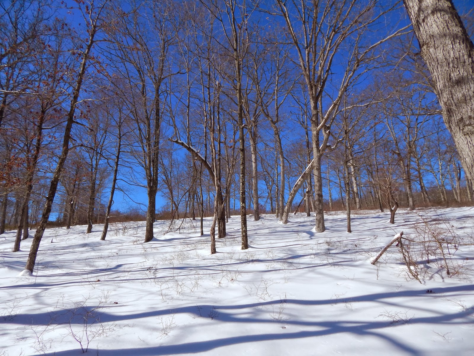
Beautiful snow, trees, and sky!


The pond, covered with snow.

At least near the shore, the pond was frozen solid!

After enjoying the pond is when things got crazy.  Mark and I started to get a bit chilly, so we moved on from the pond.  Had we been smart, we would have simply taken the AT back and done the trail in the four hours it usually takes.  BUT NO.  Having taken the Dunnfield Creek trail back in September, I wanted to enjoy its beauty again.  So, we started up the little hill and quickly realized that the trail was very different from the AT.  First of all, there was no definite trail, only two snow shoe tracks providing directions.  The snow was around two feet deep, and every five steps or so we fell through the top layer and into the coldness.  BUT, for some reason that I most certainly cannot explain, we decided the best thing to do would be to keep going.

And that was how we found ourselves too far to turn back, slogging through endless snow, and occasionally losing the snow shoe tracks.  Five hours later the sun started setting, and we were out of food.  We were absolutely exhausted, and our feet were dangerously wet in the below freezing weather.  Dunnfield Creek Trail involves seven different creek crossings, and the snow made it impossible to see where the crossing rocks were, resulting in a lot of falls.  Thankfully the Delaware Water Gap is one of the few places I hike that actually gets phone reception, so I was able to alert some people as to where I was - just in case.

An accurate portrayal of what this trip was like.


A little off-trail trudging to make it back.

Since I'm writing this, it's obvious that Mark and I made it through, but it was eight hours from when we started and well after nightfall (thank goodness I had a flashlight).  It was of course my own stupidity that caused the insanity, but it was a lesson well learned.  My muscles were so sore from dragging my legs in and out of the snow that I actually had to call out of work the next day, something I don't do lightly.  Next time I want to hike eight miles in the winter, I'll do a little research about the snowfall first.  Or bring some snowshoes.

j.r.r. tolkien.
Even in hardship, keep wandering.