Location: Baxter State Park, Maine
Season Visited: Summer
Trail Length: 9.8 miles (Helon Taylor - 3.2, Knife Edge - 1.1, Saddle Trail - 2.2, Chimney Pond - 3.3)
Time to Hike: 12 hours
Difficulty Level: 5
I've been fascinated by the Appalachian Trail ever since picking up a
book about it when I was a kid. It proclaimed Katahdin as the ultimate
terminus, a fittingly dramatic ending to a life-changing hike. Inside this
book was a photo of the Knife Edge trail that boggled my mind. Even
though Knife Edge wasn't actually a part of the AT, I knew I had to
hike it. For me, hiking Katahdin was the realization of a childhood
dream. It was also the most physically challenging thing I have ever done.
My husband and I made the trek to Baxter State Park from Kokadjo, Maine, of "Population Not Many" fame, taking the 60-mile dirt road pretty much all the way into the park, which was an adventure all its own (an adventure that caused my car to need some serious brake repair upon our return to civilization).
I have been to Maine many times, but this trip broke my moose-sighting record with a whopping 12 moose in 7 days.
The very helpful road signs...
We arrived at the park and checked in at the visitor center with our reservations as required, and went over our route with the rangers, who offered extremely helpful advice for modifications to our route. I knew I was taking Helon Taylor and Knife's Edge up Katahdin, but finalized my decision to take the Saddle and Chimney Pond trails down after consulting with these nice folks. Here you can find most of the helpful information I used to plan my trip, including the mileage and brief descriptions for multiple trails up the mountain and a basic map of the trail heads from Roaring Brook Campground, where we stayed. Obtaining reservations to camp and hike is an involved process. Follow the given links to make your online reservations and follow instructions carefully.
Behind the visitor center I got my first view of the mountain.
Sean and Katahdin.
The rest of the first day I spent hiking the little Nature Trail
off Roaring Brook campground, which was far more beautiful than I expected.
That will be my next post.
After a decidedly un-restful sleep due to
the antics of some sort of horribly-chaperoned youth group, Sean and I awoke at
the crack of dawn to hike the mountain. The rangers assured us that
maximum hike time of Katahdin was 12 hours, so we started our hike at exactly
6:00 am... and returned at 6:15 pm. We are a pair of glacially-paced
rebels, Sean and I.
The hike starts on Helon Taylor trail, ascending steadily for 3.2 miles. It is grueling, but gorgeous. The woods are lovely, but the views above the treeline two miles in are unparalleled.
A small amount of scrambling is required in the woods, but most is reserved for the last mile of Helon Taylor, which is basically all rocks and climbing.
Heading up, maintaining high spirits.
Going up, up, and up.
Catching glimpses of the mountain; realizing that the entirety (and I really do mean the entirety) of the hike is walking on rocks.
Once the trees thin you have a marvelous view of Knife Edge. This was about the time when I started to realize that I had gotten myself into a very massive undertaking. From here until you reach Chimney Pond trail, you will mostly be moving vertically instead of horizontally. It is both exhausting and exhilarating. The rest of Helon Taylor takes you to the Pamola summit, where Knife Edge begins.
Our first real view of Knife Edge.
Mostly bare rock up here.
Looking back down at our progress so far.
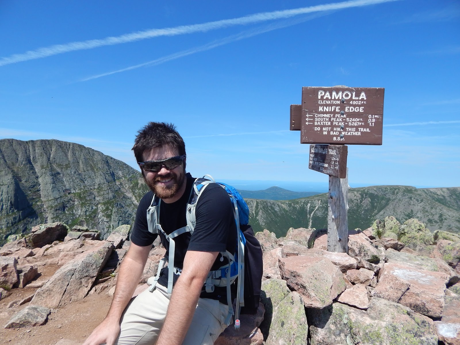
Summit of Pamola.
The summit of Pamola offers amazing views of the mountain as a whole. You can see Knife Edge and the two peaks you'll come to on your way to the grand finale: Baxter Peak.
Then Knife Edge begins. I cannot describe how frightened I was on this trail to the summit of Baxter Peak. I couldn't get the pictures I wanted because I didn't dare let go of the rocks to take out the camera, so the scariest parts are undocumented. The trail is about three feet wide in most places, entirely rock-based, with deathly drops on either side. Several people have died on this trail, and I spent the whole time telling myself that I would not be one of them.
Fortunately (maybe?), the most terrifying part of Knife Edge is at the very beginning, so once you've accomplished that the rest is not quite as bad. This is Chimney Peak, an unofficial summit only 0.1 miles into Knife Edge. It's basically a sheer wall of rocks that you have to ascend and descend to continue with Knife Edge. It requires significant upper body strength (especially for a short person) to hoist yourself up and down the rocks, all while trying not to fall to your death. At no other time during the hike was I more frightened that I was going to die, but I'm still here!
Sean bravely blazing the trail in front of me.
Looking down.
Hiking Knife Edge, a trail only 1.1 miles long, took us an hour and a half. Thankfully, all of the half-crawling/half-walking finally takes you to South Peak, and then to the climax of your trip at Baxter Peak. The level of celebration at Baxter Peak was wonderful. People were living lifelong dreams up there. One couple got engaged right before we showed up, and they shared their water with us when Sean and I ran out during the descent (we had entire Camelbaks filled to the brim and still ran out, which should let you know the insane amount of water we consumed). We met a guy with a tattoo of the elevation (5267') who said he hiked it several times a year. We met people who, like me, had been dreaming of hiking it for years. Everyone was family up there, a family that had made it up to the summit together.
View from South Peak down Knife Edge.
Cairn on Baxter Peak, putting the mountain a mile into the sky.
Victory!
Sean and I didn't stay too long at Baxter Peak since we were moving much slower than expected, so after congratulating ourselves and others on our success, we started our way down Saddle Trail. The first mile is a gradual rocky descent to the real fun: The Saddle, a rock slide that descends steeply to Chimney Pond. Going down The Saddle is hard work, especially when you're out of water. It's difficult to summon up more adrenaline, but the trail really is enjoyable. Chimney Pond at the bottom is a spectacular reward in itself, offering views of everything you've just accomplished.
2.2 miles to Chimney Pond, 1.9 miles to Caribou Spring, where I filtered more water.
Saddle Trail. You can see where it drops off the side of the mountain.
View of The Chimney from Saddle Trail. Pamola peak is to the left (people on top); The Chimney to the right. Climbing that jut of rock was the scariest part of the whole thing.
Grass and shrubbery reappearing.
Make the right and start descending!
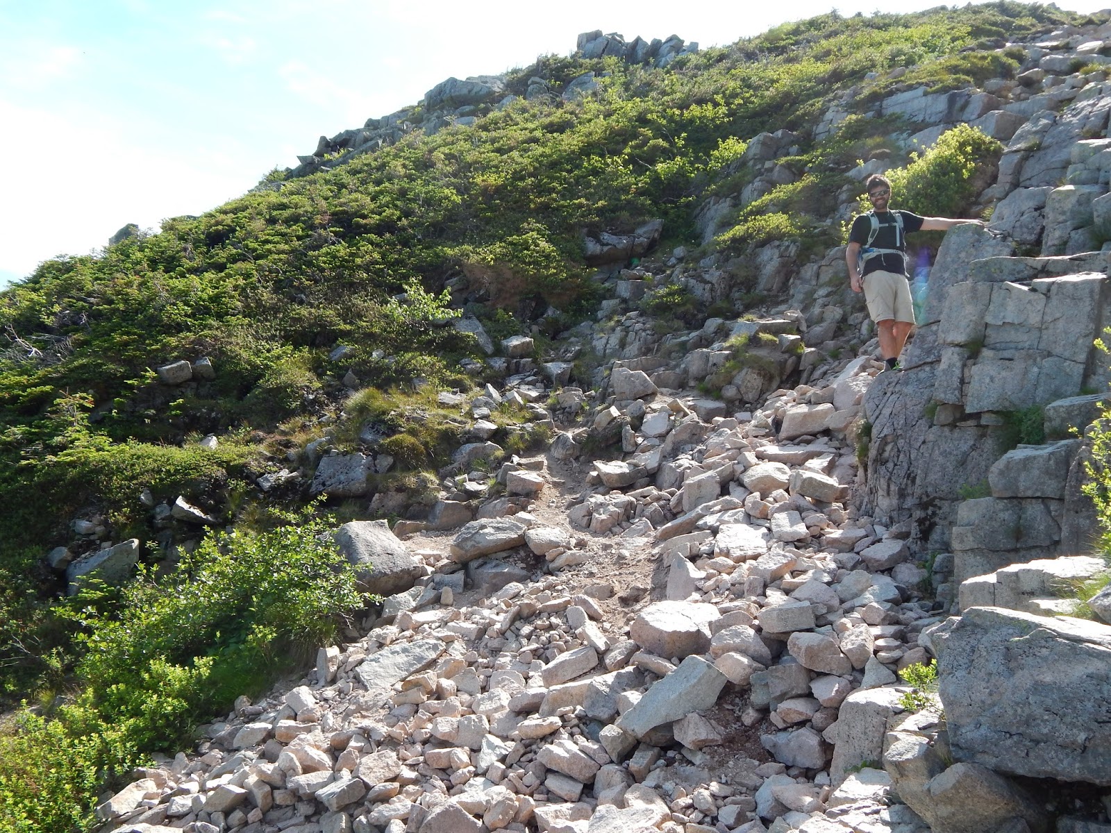
The edge of the rock slide before steep descent. You're basically hiking down a rocky cliff.
Trees reappear. Notice the continuation of hiking solely on rocks. It gets old.
So happy to be at Chimney Pond!

The next 3.3 miles should be comparatively relaxing. You're finally moving horizontally for a long period of time. While technically easier, you're probably so exhausted at this point that it doesn't feel much easier at all. Keeping my legs moving was a challenge. That said, this section has nice features like bridges and boulder fields. It also has an abundance of smaller boulders... on the trail. Sean was very fed up with this by the end.
Bridge break.
Sean had a very endearing message for the rocks.
This is around the end of the trail. Looking back on our progress, we couldn't help but be proud.
That night, Sean and I abandoned our reservations at the campground and stayed at a hotel as a treat to ourselves. Hiking Katahdin was more mind-blowing than I had ever imagined - and far more physically challenging - and before sleeping harder than one of the rocks on the trail Sean and I had to laugh at our own naivete in thinking it would be a cakewalk. Still, it was by far the best hike of my life... so far.
Keep on wandering.