Showing posts with label backpacking. Show all posts

Friday, April 27, 2018

David English and Twin Ponds Cut-Off Trail


Location: White Clay Creek State Park, Newark, Delaware
Season Visited: Spring
Trail Length: David English Trail is 2.4 miles long. If you make it a shorter loop from the park office by taking the Twin Ponds Cut-Off Trail, I estimate the hike to be about 1.6 miles. The cut-off trail itself is 0.4 miles. You can see the layout of the trail (and other trails in the park) on this map.
Time to Hike: Hiking the full David English Trail took us about 2 hours, going at a toddler's pace some of the way. Doing the short loop via the cut-off trail when said toddler was a small baby took us 1.5 hours.
Difficulty Level: Moderately easy.

I have written before about trails in White Clay Creek State Park. This post is actually two posts in one, as I have hiked this trail twice now. The first time was in May 2017 when my son was three months old. The first part of this post and the accompanying pictures are from that hike. The goal that day was to hike the entire David English Trail, but the baby was not having it and we ended up taking the cut-off trail to make a shorter loop back to our car. The second time was a couple of weeks ago, the beginning of April, with a much more adventurous 14-month-old! This park is close and pretty and has easy hikes - perfect for a new mom or families with young children. The David English Trail in particular is a good choice because you can decide at the halfway point whether you want the hike to be short or a bit longer depending on how your family is feeling. Be warned: on a warm April day you will have to get out of the way of a LOT of bikers.

Both times, in addition to my son, I went with my husband and sister to the hike, which starts at a trailhead at the following coordinates, near a park office:


One nice thing about the White Clay Creek trail markers is that they include coordinates!

As you can see on the map, the trail has three different ways you can go almost immediately. We decided to go left here. This put us directly on the David English Trail, walking on relatively level ground. Going right would also have put us on the David English Trail, but there looked to be an incline, and we decided to go easy on ourselves since this was only my second-ever hike with the baby back in 2017. What followed was a mostly flat dirt trail.


With the newest addition!

My sister is obviously highly enjoying her quality time with nature.


Further on we came to a bench, where I fed the baby and let him chill out of the carrier for a while. At the time I was experiencing quite a bit of difficulty hiking with him because he did not like the carrier under most circumstances. Now that he can sit in a backpack - or walk - he has taken to hiking with joy.

It was only a year ago, but he looks so much smaller than he does now, as you will see!


Here you can see how the trail looks in April from our most recent trip:

There is much less foliage in April. This is the trail just past the parking lot.

Past the bench the trail opens up, coming to a sweet little pond filled with turtles, and where we spotted many small birds. Both times I've been to this pond I've seen eastern bluebirds. After the pond, the trail meanders back into the woods. Near the end it becomes a bit more steep, and you do have to put in a bit of effort, especially if carrying a toddler on your back. It's never difficult, however. In season you can see a lovely magnolia tree blooming near the park office before returning to the parking lot. These pictures are from the April 2018 trip.

My sister and dog.

Baby boy loves hanging out in the Osprey carrier.


Conked out.

I was very happy to be able to complete the trail this time around. A successful hike with my son has definitely renewed my confidence as I begin to hike more often with him. I can't wait to share more of our adventures with you.

Saturday, May 14, 2016

Corbin Cabin and Nicholson Hollow

Location: Shenandoah National Park, Virginia
Season Visited: Fall
Trail Length: 4-mile loop (1.3 miles Day One; 2.7 miles Day Two)
Time to Hike: 2 days
Difficulty Level: 2

Early in October of last year, I set off with my husband to do a moderately easy overnight hike in Shenandoah.  This trail features a beautiful babbling brook and some old cabin ruins, as well as the still-standing Corbin Cabin from 1909.  The fall colors were really starting to shine and the weather was perfectly chilly on this lovely autumn weekend.

I followed this itinerary and used this map to get an idea of where I wanted to go.  We began our hike in the parking area just before mile marker 38, on the right-hand side of Skyline Drive, crossing the road immediately onto the Corbin Cabin Cutoff Trail.  This goes 1.3 miles down into the Hollow, ending at the Hughes River stream crossing.

The beginning of Corbin Cabin Cutoff Trail.


Debris in the way.


Cabin ruins.


Hughes River stream crossing.

The itinerary recommends turning left and finding a place to camp downstream, and there are definitely plenty of nice camping spots down there.  The rangers told me before the hike, however, that there was also some nice camping just beyond Corbin Cabin, so Sean and I continued on across the stream.  Once across, Corbin Cabin was straight ahead of us.  After checking it out, we continued on the trail that turns right after crossing the stream.  I believe this is Indian Run Trail, but it's really only a connection to the Nicholson Hollow Trail for the purposes of this hike.  Up beyond Corbin Cabin on this trail is a nice clearing where we set up camp.

Looking at Hughes River from the other side.

Corbin Cabin.  Some folks had rented it for the night.

Camp.

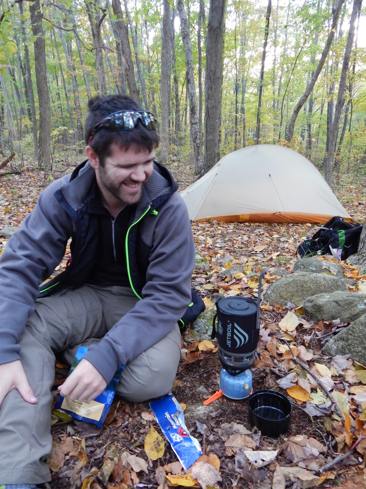
Dinner time!


Heading back down to the stream to get water for the evening.

The night spent near Corbin Cabin was relaxing and thankfully uneventful.  As fun as it is to have crazy backpacking night stories, it's nice to enjoy those rare occasions when you actually make it through an entire night without being woken up by animals, cold, storms, etc.  This night was one of the peaceful ones.

The next morning was the hike back up Nicholson Hollow Trail, which took us to Skyline Drive.  From there we took the short connecting trail to the Appalachian Trail, northbound, which led us right back to our car.

Good morning!

Another stream crossing on Day Two.


Catching mountain glimpses through the trees.


The most enjoyable part of the second day was seeing the distant mountain skyline through the turning trees.  Though somewhat uphill, the hike is not difficult.  Overall, the hike to Corbin Cabin is both peaceful and interesting.  The cabin ruins provide a reminder of Shenandoah's rich (and still, to some, controversial) human history, while the trees and streams in this designated wilderness area offer the beauty of deep woods without an overly long trek.

Enjoy the hike, and keep wandering.

Tuesday, September 1, 2015

Neighbor Mountain

Location: Shenandoah National Park, Virginia
Season Visited: Spring
Trail Length: Estimated 10 miles there-and-back, about 5 miles each day for two days
Time to Hike: 2 days
Difficulty Level: 2 on Day 1 (mostly downhill) and 4 on Day 2 (hiking back up)

Back in May I completed an accidental hike of Neighbor Mountain.  I say "accidental" because it was only due to a navigation error on my part that I ended up on this trail!  I meant to complete this hike, but a few intersections on the trail were overgrown and confusing, so my husband and I, along with Cleo the hiking yorkie-poo, ended up realizing our mistake two miles into the wrong trail.  The trail was so lovely, however, that we just kept going!  Although I had never been to the Neighbor Mountain trail, my map told me that it connected to Jeremy's Run Trail, and I remembered reading somewhere-or-other that backcountry campsites were abundant there.  So that's where we went, and, given that we had a spectacular time, the accident turned out to be quite fortuitous indeed.

We began our hike around mile 27 of Skyline Drive, in the Neighbor Mountain parking area.  Neighbor Mountain trail runs parallel to the Appalachian Trail for a short time, and then breaks off to both the left and the right!  Very confusing.  Apparently we went right when we should have stayed left, although given that I didn't know I was going the wrong way, I am only assuming that that is when we made our mistake.  Regardless, if you want to do what we did, I guess you stay to the right!  This keeps you on Neighbor Mountain trail, where you climb very slightly to the summit of the mountain.  The hike is moderately easy and there is not much scenery besides the tunnel of green.  Just FYI, I have never been to Shenandoah in May without seeing a bear, and this trip was no exception.  We saw a bear from our car on Skyline Drive before beginning this hike (sorry no picture this time!), and then heard what sounded very much like a bear right around the summit of Neighbor Mountain on both Day 1 and 2.  You should know this anyway, but always keep bear rules in mind when you hike in Shenandoah.  Hang your food, show no fear, and for the love of Mother Nature - DON'T RUN if you see a bear.

Cleo on Neighbor Mountain Trail.

Cleo: Did I hear a bear?!?!?! 

Post marking the summit of Neighbor Mountain.  Neighbor Mountain Trail totals 4.6 miles.  From the parking area, I estimate about .4 miles, which is how I'm getting the 5-mile total distance for this trail.  You also have to walk a very short distance on Jeremy's Run for the abundant campsites.

As the post indicates, once you reach the summit of Neighbor Mountain you have 2.6 miles to go until you reach Jeremy's Run.  This section of the trail is extremely enjoyable.  For starters, it is pretty much entirely downhill, which is always a plus in my book.  There is also a gorgeous section of mountain and valley views as you scale the lower ridges of Neighbor Mountain, leading to the wooded streams of Jeremy's Run.  I adore Shenandoah in May because everything seems to be alive.  The trees, flowers, bears, butterflies - everything has finally shaken off the last of winter's chill.


Hey!  No smartphones allowed in the wilderness :P


The water of Jeremy's Run.

Once you reach Jeremy's Run, all you have to do is find a campsite.  Paradoxically, this can be both difficult and easy.  It's easy in the sense that the ground is level and campsites are easy to spot; there are many large, preexisting sites.  It can be difficult, however, because Jeremy's Run is a very popular place to camp.  There were numerous families with large camping setups at the very beginning of Jeremy's Run.  Thankfully, Sean and I found a "secret spot" by the stream.  It must have been one of the lesser-known sites in the area, because we had to cross the stream to enter it as well as climb over some large fallen branches and pick our way through some stinging nettle (which I swear looks completely different in Virginia than it does in Jersey/Pennsylvania, or at least that's what I'll keep telling myself so I don't feel totally stupid for getting like four different nettle rashes on my legs).  I'm also not 100% positive that the site was legal.  It was kind of pushing the 10 yards from a stream rule and there was a fire ring (which of course we did not use because NO FIRES IN THE BACKCOUNTRY, DUH), buuuuuut it was pretty darn close and so secluded and nice that we just had to stay there :)

Sean before we set up camp.

Stream by our campsite.

It was SUCH a beautiful day/night, that the rainfly was not needed.

The night we spent at Jeremy's Run was perhaps the nicest and most comfortable night I have ever spent backpacking.  The weather was completely perfect.  The site was level and listening to the soft stream was exceptionally relaxing.  I fully intend to camp here again.

The next day is the hard day.  You can, of course, continue on Jeremy's Run and make a full loop, which I plan to do sometime.  But, since our trip was an accident, we decided to just re-trace our steps because we had no knowledge of how long or strenuous the rest of Jeremy's Run was.  The climb back up is moderately difficult, but we were honestly surprised that we felt so good during the ascent.  I guess getting a good night's sleep is worth its weight in gold!

Crossing the stream in the morning.

Headed back up from Jeremy's Run.

Everything considered, our accidental hike to Neighbor Mountain was a complete success.  This hike is lovely, especially the camping.  Enjoy it if you go, and keep wandering!