Showing posts with label National Natural Landmark. Show all posts

Sunday, February 23, 2014

Sunfish Pond - Winter

I went back to Sunfish Pond last week, and my goodness was it an adventure!  (See my post from September 2013 for more information about Sunfish Pond, including summer and fall photographs.)

I don't know why, but I was under the impression that despite the recent heavy snowfall the trails would be relatively clear and easy to hike.  I was only half correct, and the mistake was almost very costly.  Follow me on my adventure as an example of what not to do when winter hiking for the first time.

AT beginning.

My friend Mark and I started on the AT to Sunfish Pond without too much difficulty with the snow.  I was, however, far more out of breath than I was comfortable with, probably due to the fact that I haven't done any hiking whatsoever in two months (darn you winter!).  Still, the snow was only about three inches deep on the trail, and as long as I didn't step into the two feet of snow on the side of the trail then everything was fine.

Mark at the Sunfish Pond sign.

The snow got deep at times, but it was fine on the trail, and we made it to the pond in two hours - exactly the time I was hoping to make.

Snow up to the knees off the trail!

Beautiful snow, trees, and sky!


The pond, covered with snow.

At least near the shore, the pond was frozen solid!

After enjoying the pond is when things got crazy.  Mark and I started to get a bit chilly, so we moved on from the pond.  Had we been smart, we would have simply taken the AT back and done the trail in the four hours it usually takes.  BUT NO.  Having taken the Dunnfield Creek trail back in September, I wanted to enjoy its beauty again.  So, we started up the little hill and quickly realized that the trail was very different from the AT.  First of all, there was no definite trail, only two snow shoe tracks providing directions.  The snow was around two feet deep, and every five steps or so we fell through the top layer and into the coldness.  BUT, for some reason that I most certainly cannot explain, we decided the best thing to do would be to keep going.

And that was how we found ourselves too far to turn back, slogging through endless snow, and occasionally losing the snow shoe tracks.  Five hours later the sun started setting, and we were out of food.  We were absolutely exhausted, and our feet were dangerously wet in the below freezing weather.  Dunnfield Creek Trail involves seven different creek crossings, and the snow made it impossible to see where the crossing rocks were, resulting in a lot of falls.  Thankfully the Delaware Water Gap is one of the few places I hike that actually gets phone reception, so I was able to alert some people as to where I was - just in case.

An accurate portrayal of what this trip was like.
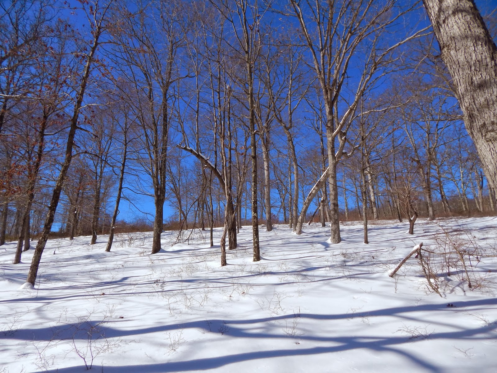


A little off-trail trudging to make it back.

Since I'm writing this, it's obvious that Mark and I made it through, but it was eight hours from when we started and well after nightfall (thank goodness I had a flashlight).  It was of course my own stupidity that caused the insanity, but it was a lesson well learned.  My muscles were so sore from dragging my legs in and out of the snow that I actually had to call out of work the next day, something I don't do lightly.  Next time I want to hike eight miles in the winter, I'll do a little research about the snowfall first.  Or bring some snowshoes.

j.r.r. tolkien.
Even in hardship, keep wandering.

Sunday, November 24, 2013

Hawk Falls Trail

Location: Hickory Run State Park, Pennsylvania
Season Visited: Fall
Trail Length: 0.6 miles there-and-back
Time to Hike: 25 minutes
Difficulty Level: 2

Hickory Run State Park  is an interesting and diverse state park in the Poconos in Pennsylvania.  It has 44 miles of hiking trails ranging from very easy to moderately difficult and some amazing scenery, including its famous Boulder Field.

Sean and Cleo at the boulder field, a National Natural Landmark.

Hawk Falls Trail is short and sweet.  It's perfect for beginning hikers or when you just want to take a stroll, but still want to see a nice waterfall!  Begin your hike at the parking area just past the Rt. 476 overpass, as if you were leaving the park on Rt. 534.  Park on the right-hand side of the road and you'll see the Hawk Falls Trail sign a little to your right.  Hawk Falls Trail is letter J on this map.


The trail begins with a downhill walk through some rhododendron.  Before long you come to a bridge over a creek.  There are plenty of little places to explore off the trail.


Past the bridge, continuing on the trail.

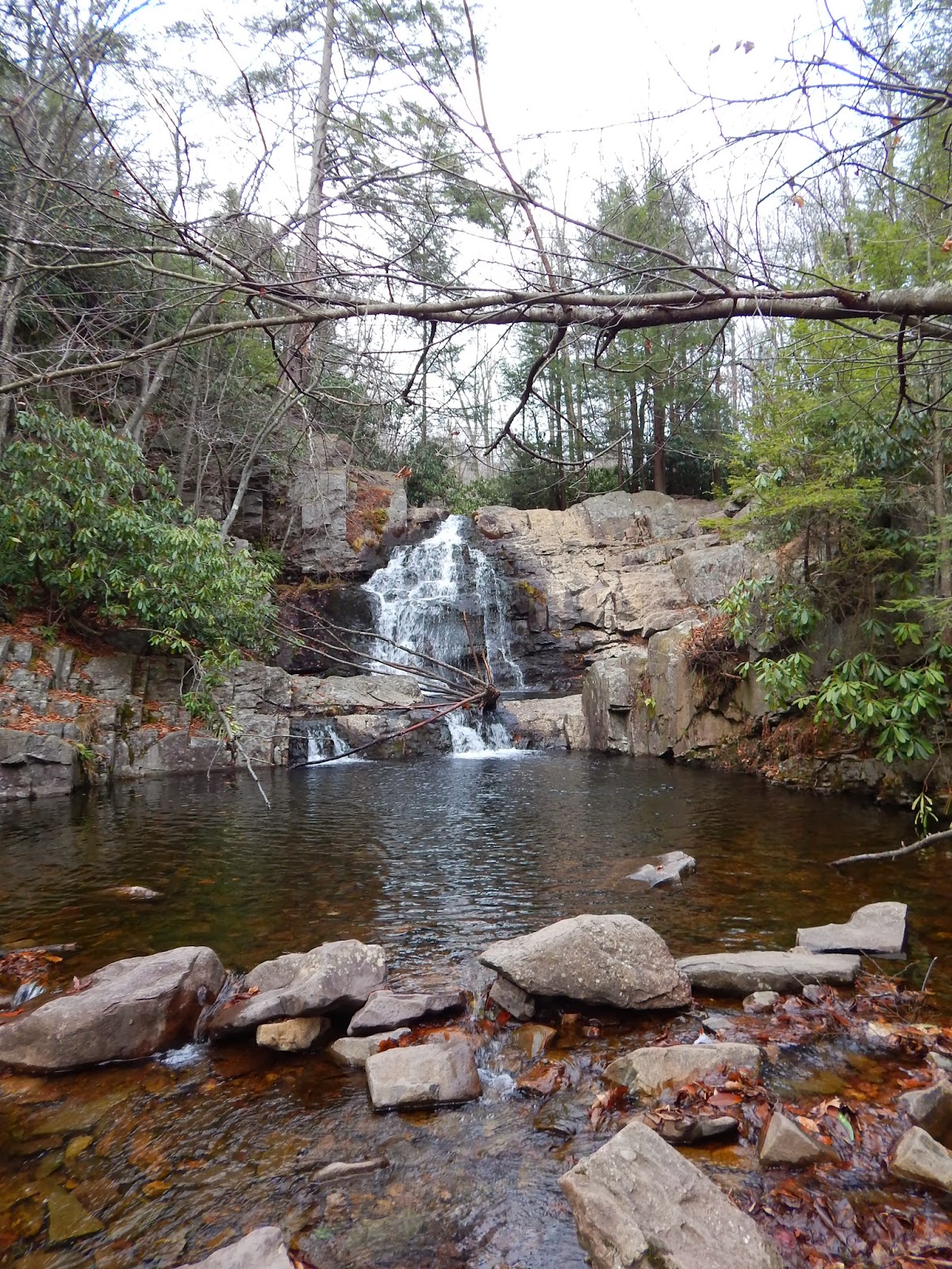
A little further on and to the left you'll notice a rock outcropping a few feet off of the trail.  Be sure to spend some time here, because it is your first view of the 25-foot waterfall.  There are some rocks to climb on and if you're feeling a bit adventurous you can scramble down to the foot of the falls, and also around the top!


There is also a nice place to stop and look at the water of Hawk Run when you continue down the trail.


The trail then leads you through a tunnel of rhododendron and down to the foot of the falls if you haven't climbed down there already, as I did.  Again, it's fun to climb on the rocks.  I recommend climbing them back up to the outcrop instead of taking the trail back around, just for the fun of it :)


Some last pictures with the falls before heading back.

When you're done with the falls, all that's left to do is retrace your steps.


Quick and easy, Hawk Falls Trail is a nice way to spend a little leisure time at Hickory Run.  There are plenty of other trails nearby, so feel free to extend your trip!  Enjoy your hike, and keep wandering.


Saturday, September 7, 2013

Sunfish Pond

Location: Worthington State Forest, Delaware Water Gap, New Jersey
Season Visited: Summer
Trail Length: 7.6 miles there-and-back
Time to Hike: 4.5 hours
Difficulty Level: 3

Sunfish Pond is a fascinating stop along the Appalachian Trial in northern New Jersey.  A beautiful pond created by a glacier, this lovely spot was declared a National Natural Landmark in 1970.  The trail there and back is a perfect half-day hike, and there are many options for extending the trip, including at least one loop and, of course, simply continuing on the AT.


Begin your hike at the Dunnfield Creek Natural Area parking lot and head straight to the AT, which is number 1 on this map.  Hike an easy gravel path until you come to the sign shown above, where you will be veering left at the fork to stay on the AT.  You will begin a steady uphill incline of 1000 feet in the next 3.7 miles.  It's perfectly manageable.


The trail looks mostly the same for the majority of the trip, but it never becomes boring.  The woods are gorgeous and peaceful.  On an absolutely perfect Friday in late summer when most people are still at work the trail is almost silent except for the sounds of birds and the wind in the trees.  Every time I got a little tired I sat on a rock and watched the sunlight play on the ferns and felt rejuvenated.

There is one very interesting place before you come to Backpacker Site #2 on the map, which is where the scenery starts to change a bit.  This is a rock garden filled with interesting little cairns.  There are several other cairns along the trail, but this is a particularly large gathering of them.  There are even more at the pond itself.

Cairns.

Once you hit Backpacker Site #2 be sure to stay to the right or you'll end up on the wrong trail.  The site itself is maintained by a national park ranger who keeps an eye on things.

The forest looks different here, right past the backpacker site.

Not long after this you come to the pond itself.  Take the AT past the NNL monument and enjoy exploring around the pond for a while.  Go right to the water's edge as slowly and quietly as possible and you will see more frogs than you can count.  There is also a wonderful little place to rest on some logs.


Pose at the pond.


Cairns across the water (cairns across the sky... nevermind).

Sean and Cleo taking a break.

So many frogs!

When you've rested up and taken in the beauty of the pond you can simply head back the way you came.  There is also the option of taking Dunnfield Hollow Trail.  I did not take this because of time constraints, but I would like to go back and do it this way at some point.  It is supposedly much more difficult and makes an 8.2-mile loop.  It also apparently has some lovely water cascades and a few stream fords.  I'll update this post if I ever take that way.

If you are so inclined, feel free to make a brief stop at the little waterfall where the AT intersects with the Blue Dot and Dunnfield Hollow trails, where you made the left turn in the beginning of your hike.  It's a nice way to end the day.


From here it's the same easy hike back to the parking lot.  Hopefully you have had a great time hiking.


Never stop wandering.


UPDATE - 11/5/13

Back in September I decided to take the 7.9-mile loop by connecting the Appalachian Trail and Dunnfield Creek Trail - and was so glad I did.  Although it only adds .3 miles to the trip, Dunnfield Creek Trail (or Dunnfield Hollow Trail, depending on the map you're using) adds a whole new dimension to the Sunfish Pond experience with quite different terrain.  It is extremely rocky and a bit more difficult than taking the AT back, but, as I said, is definitely worth it for the change in scenery.  I will strongly advise, however, that you do what I did and take the AT up and Dunnfield Creek back.  I pitied the few people I saw taking Dunnfield to the pond.  That would be quite an arduous trip.

The pond is absolutely beautiful in early fall.  The only thing I missed was the green of the ferns and the seemingly endless amount of frogs hopping around.  In late September, though, the trails have a charm of their own.  Here are a few pics of the AT up to the pond in September.


After taking the AT to the pond and enjoying the view, it's time to walk to the Dunnfield Creek Trail, which is clearly marked right past the pond.

Dunnfield Creek Trail to the right of the Sunfish Fire Road.  Cleo the amazing hiking yorkie-poo in the foreground.


The trail is immediately beautiful, and quite different from what you experienced on the AT.  Right past the bend pictured above is a short section of extremely closely-packed trees and shrubs, leaving only about a foot of breadth on the trail.  It is a very different feel from the open undergrowth of the ferns on the AT.  You then come out to an open section and get a sense of your elevation.


Beyond another ferny section and some relatively steep downhill hiking comes one of the highlights of this trail: Dunnfield Creek.  While really only a little trickle of water, it is enough to form some peaceful cascades that keep you company while you hike.  There are a few nice places to sit amongst the rocks.  Keep in mind that there are also a number of places where you will need to cross back and forth across the creek on these rocks.  It will be obvious where you need to cross.


This eventually leads you right back to where you started at the Appalachian Trail.  Take this back to where you parked and your hike is complete!

Hopefully you have enjoyed this update.  If you're going to Sunfish Pond I highly recommend taking this loop.  It adds a negligible amount of mileage and no extra time.  Keep on wandering!