Tuesday, August 25, 2015

Laurel Prong and Hazeltop

Location: Shenandoah National Park, VA
Season Visited: Spring
Trail Length: 7.4 miles (about 4.3 miles on Day One and 3.1 miles on Day Two)
Time to Hike: 2 days
Difficulty Level: 2

I completed my first backpacking trip of 2015 back in the first week of April, and then had such a good time that I went back again two weeks later with my husband and my dog!  This hike is a great backpacking trip for beginners in moderate shape.  It's enough to give you a workout but not enough to exhaust you.  If I was ever taking a complete beginner on a trip, this would definitely be one of my go-to trails.

I used this itinerary and this map for my trip.

The hike starts at Milam Gap parking, between mile 52 and 53 of Skyline Drive.  It's a good-sized parking lot and finding a spot was not an issue at all.  Cross Skyline Drive pretty much immediately to head south on the Appalachian Trail.

AT post after crossing Skyline Drive.

Hike the AT for 2.6 miles and then turn left on Laurel Prong Trail, where you will be sleeping for the night.  Everything is well-labeled and easy to follow.  I always check the posts, even if I know where I'm going, to ensure I'm never lost.  There are some beautiful views of the mountains, if you look for them.  The first time I hiked this trail I totally missed an amazing viewpoint that my smart little dog scoped out the second time.

Cleo the hiking yorkie-poo is at it again!


Laurel Prong Trail turns sharply left at one point (you can see it on the map), taking you along a really neat ridge with rock formations.  Hiking for a while after the ridge you return to the woods, and if you're looking for it, there is a very obvious camping spot on the right-hand side of the trail.  It's just before a tiny creek crossing, so if you've come to that then you've gone too far.  This little creek beyond camp is where we filtered our water.

Ridge line - the first time.


Cleo on the ridge.

The campsite is spacious, but we did have to clear a bunch of fallen branches out of the way that were not there two weeks before.

Cleo by the creek.


The next day is exceptionally interesting.  As Sean said, the first day can be a bit boring if just walking in the woods isn't enough for you.  The second day features some awesome history at Rapidan Camp!

If you camped in the big spot on Laurel Prong trail you've got a little while before you see Fork Mountain trail go off to your right (which you bypass).  In the spring, the trail can definitely be wet, but if you're hiking this time of year you're probably already prepared for that, right?

Wet, early morning trail.

The intersection with Fork Mountain.  You can't camp past this point.

Follow Laurel Prong along and you will come to the really cool Rapidan Camp.  Explore the area!  There are neat historical buildings, both a wooden and metal bridge, and a waterfall.  During normal hours I think they have rangers and exhibits there, but I was either way too early in the morning or too late in the evening when I went.  Personally, I very much enjoyed the solitude.


There's also this little trail called Five Tents Trail that spurs off of Laurel Prong.  It's really short but steep if you're already a little winded, and to be honest there's really nothing there but an old foundation.  I guess if you're into foundations then, by all means, go check it out, but there's nothing you didn't already see at the Camp itself.

When you've had enough, find Mill Prong trail.  It was a little hard for me to find at first but once I saw the post it was pretty obvious.  Just look for the metal bridge.  It's right around there.  FYI - there is an outhouse past the metal bridge (which I did not take a picture of, sorry).  That outhouse was NOT stocked with toilet paper at the time I went, even though it had a dispenser.  And that was really unfortunate, because the second time I went I ran out of toilet paper.  And had to use a leaf.  So yeah, just so you know.

Post at the beginning of Mill Prong.

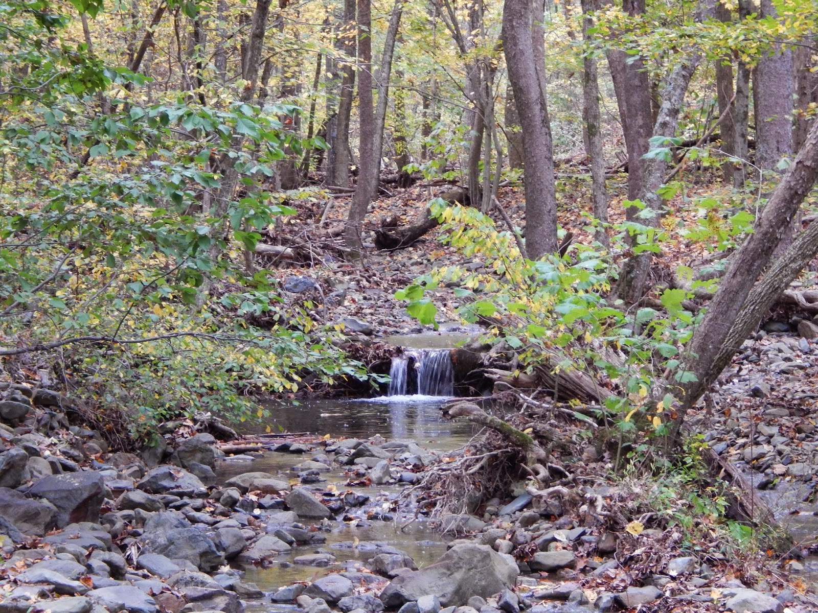
Waterfall on Mill Prong Trail.

Stones to cross, in front of the waterfall.

So, you may or may not know this, but one of Shenandoah's most magical features is the large-flowered trillium that blooms in the park between March and May.  It is the park's logo and is a spectacular flower.  The first time I made this trip in the first week of April, the trillium had not yet bloomed.  But in the middle of the month it was all around this waterfall.  Seeing trillium in Shenandoah is one of my favorite things and the blooms around the waterfall were just gorgeous.

Large-flowered trillium.


Past the waterfall a bit you will see the split for Mill Prong and the Mill Prong horse trail.  Be sure to stay left on Mill Prong, because the horse trail ends up very out of your way!  After that you will encounter two stream crossings, neither of which is daunting.  Finally, the brush will change and you will make your way up a small rise back to Skyline Drive and the parking area.

Mill Prong and Mill Prong horse trail split.

First stream crossing.

Second stream crossing.

Slight incline at the end of the trail.

And that's the hike!  Remember on your drive home to keep an eye out for deer on Skyline Drive.  They're EVERYWHERE.  And keep on wandering :)


Sunday, March 1, 2015

South River and Pocosin

Location: Shenandoah National Park, VA
Season Visited: Fall
Trail Length: 8.6 miles (about 3.8 miles on Day One and 4.8 miles on Day Two)
Time to Hike: 2 days
Difficulty Level: 4

Shenandoah National Park in November is a VERY different place than it is in October.  If you recall from my previous post, the park is a zoo in October.  After the first week of November, it really felt like a ghost town.  It might also have had something to do with the fact that I went on a weekday and that it was raining, but I could not believe how few people I saw during my overnight backpacking trip.  Fortunately, that's just the way I like it.

I followed this itinerary and this map for my trip.

The hike starts at the South River Picnic Area.  This place has a ton of parking, so finding a spot is not a concern for this hike.  There are picnic tables and even a bathroom at the trailhead, so you can have one last snack and potty break before you start eating in the dirt and peeing behind trees.

On the day I went I was lucky enough to spot an absolutely amazing rainbow on Skyline Drive in between storms, so here are some pictures of that!


After taking in the views and parking, hike South River Falls Trail.  I've visited this trail before (twice, actually) and wrote about it here.  The part that leads you to the lookout is relatively easy, although of course it was muddy in the November rain!  The overlook for the 83-foot falls is one mile in to the hike.  You can get to the base of the falls by going a little farther.  The trek down to the base is steep and strenuous, especially on the way back up, and is not counted in the overall mileage. Due to this and the mud issues I was having, I decided not to make the trek.  It is absolutely worth it in nice weather and if you haven't seen it before, however.

Hiking to the falls.

A few fall colors left.


Looking to the falls.

Just past the lookout it went from cloudy to sunny, but then went right back to pouring rain after this.

After completing South River Falls Trail, turn left to connect to the South River Fire Road, and then turn right on the fire road.  I've written about how soul-crushingly awful this fire road is before, but I only had to hike a mile of it this time, so I made it through in relatively high spirits.  After this you turn left on Pocosin Trail and find a place to camp. The trail widens out before narrowing down again, and it is relatively easy to find a spot.


It's fun to see the falls, but I really found the second day of this hike to be the true highlight.  The rest of Pocosin Trail the next day is really interesting.  The trail is quiet and filled with history.  I came in close proximity to a beautiful deer, who didn't mind at all that I was in his foraging grounds.  The best part is the Mission Ruins at the end of Pocosin Trail, before you turn left onto Pocosin Road.  Sadly, my camera died that morning right after I woke up (I didn't realize non-lithium batteries couldn't survive near-freezing temperatures) and I couldn't get pictures of the ruins.  They are really neat, however, and are well-worth the trip. You can find some pictures of them on this site.

I did manage to take a few photos with my phone on the Appalachian Trail, however (not sure why I didn't think of that sooner), which is where you end up after Pocosin Road with a sharp left turn.  If you look up and to your left just before intersecting with the AT, you will see the PATC Pocosin Cabin, which offers a very slight short cut.  Even in the nasty November weather, there was a group of people relaxing in the cabin after an overnight stop, and there were actually quite a few people on the AT itself.  The AT continues back almost the entire way to the picnic area, before you make a quick right and end up right where you started.

Beautiful Appalachian morning after the storm.

A little climb on the AT.


Overall I found this to be a very nice overnight backpacking trip.  It's not outrageously strenuous but it certainly gives you a work out!  I must have a soft spot for the falls, because I seem to keep returning to them.  November in Shenandoah is a great time to find solitude, but remember to prepare for the weather.  November nights in the mountains are freezing - sometimes literally.  It is generally the last month I'll venture out into the wilderness without specialized, four-season equipment, and I'm always sure to have all the proper layers and gear.

Be prepared, savor the wilderness no matter what the weather, and never stop wandering.

Monday, January 19, 2015

Overall Run and Beecher Ridge

Location: Shenandoah National Park, VA
Season Visited: Fall
Trail Length: 12 miles (about six miles each day for two days)
Time to Hike: 2 days
Difficulty Level: Day 1 - 4.  Day 2 - 5.

I successfully completed my first solo backpacking trip back in October in - where else? - beautiful Shenandoah National Park!  Well, my dog was with me, but I was the only human :P  It was a wonderful time, and the fall colors were absolutely gorgeous the third week of October.  I couldn't have asked for better weather (with the exception of one brief little drizzle), though it was very cold!  If there's one thing you should never underestimate about Shenandoah, it's how cold the mountain air is at night.  The park was buzzing with activity as everyone and their mother admired the colors of the leaves.  I went again in November - a post hopefully coming soon - and the difference was alarming.  The place was a zoo in October, but that didn't stop me from experiencing lovely solitude during the evening and most of my second day of hiking.

The trail starts at Hogback Overlook on Skyline Drive, as seen on this map.  I arrived at the parking area (described here in the itinerary I followed) around 10:30 on a Saturday, and I almost didn't find a spot.  I basically had to shimmy my little car between a truck and a tree to be able to park there.  You've been warned - parking is insane in Shenandoah in October.

After that, however, the trip was a breeze.  If you plan to do it, first start hiking the Appalachian Trail for 0.4 miles.

Cleo and I starting out on the AT.  Nice level terrain to start with.

You then turn right on the Tuscarora/Overall Run Trail.  All trails in Shenandoah are clearly marked and I've never had a problem.  Just follow the sign posts and you'll be fine.  The map and itinerary posted above are adequate to help you along.

Tuscarora/Overall Run Trail is very lovely, and both the woods and waterfalls are sure to please.  The first waterfall you come across is a 29-foot cascade, though you do have to descend a steep side trail if you want to reach the base of it.  I'm calling it a side trail, but really there isn't much trail at all.  I managed it with Cleo, but it did test our human-dog coordination skills!


Base of the cascade.

The climb back up to the main trail.  You kind of just have to make your own way.


After this cascade comes what is probably the true highlight of the trip: a gorgeous view of Shenandoah Valley and a look at the highest waterfall in the park - 93-foot Overall Run Falls.  There are lots of fun rocks and crags to play around - just don't fall!


Overall Run Falls.

Shenandoah Valley.

Victory!


Sweeping panoramic view.

After this majestic view is a section of steep downhill navigation.  It's not too much of a challenge, unless you have trouble with downhill hiking, as some people do.  All I can say is that I'm glad I wasn't going the other way.  Some people were, and I really felt for them!

Going down.  Further down it became rockier.


At the bottom you are greeted with a gorgeous forest floor, Stay to the left when the trail splits and you come to another lovely cascade, not marked on the map.  Just a little further on from here is where you will find comfortable, level camping spots to sleep for the night, still on Overall Run Trail.  I stayed near the brook, listening to the water in the evening and collecting my drinking water from it the next day.  Pleasant dreams!


Cascade near camp.


Water near the campsite.

Camp Sweet Camp!

Attempted to fill my camelback from this little waterfall the next day.  Not as easy as I thought it was going to be!  Hopefully it will be easier when I get my hands on a real water filter... soon, I hope!

And so begins your second day.  I definitely worked up a sweat on day one, but nothing prepared me for day two.  The itinerary made no mention of the fact that the second day is basically five miles of rather steep uphill climbing, pretty much nonstop.  My lack of knowledge was, of course, my own fault.  Because the park provides free maps online, I use those instead of breaking down and paying the 15 bucks or so that would get me a real, topographical map.  I therefore have no clue what type of elevation gain I'm getting myself into unless specifically mentioned by the itinerary.  Again, I admit full responsibility here.  Even more so, since I'm not too stupid to realize that most hikes that start from Skyline Drive go down since the Drive covers ridge lines at high elevation... and what goes down must come up.  Despite all this, I really was not prepared for the difficulty level of the second day.  It's uphill.  It's steep.  And it takes a while.  If you go, be mentally and physically prepared.

Early morning climb.


The second day of the hike also involves many trail changes.  Be alert, follow the itinerary and map, and you will be fine!

Ultimately, this hike was really nice, especially on the first day.  I wouldn't do it again without being in much better shape due to the difficulty of day two, but I am so glad I made the trek.

My first solo hike was fun, challenging, and filled with great views and adventure.  If you are a solo female hiker, please know that you should do everything in your power to get outside.  If you are like me, you are constantly being discouraged, almost entirely due to your gender.  I have been told by multiple people that, given my actions, it would be my own fault if I was murdered or raped.  These people are often close to me, the people who are supposed to encourage me and nurture my dreams.  Oddly enough, a lot of my encouragement comes from strangers I meet on the trail, who tell me how awesome they think it is that I hike alone as a female.  It feels good to be called brave, ballsy, and badass (all things I have been called on the trail), but what I really hope for is the day when a female hiking alone is commonplace, and no one doubts her ability or safety purely because of her sex.

Ladies, be prepared and don't be scared.  Trust your instincts and have a plan of action for if something does happen to go wrong.  Don't give in to fear.  YOU are the only thing standing in the way of your dreams.

Keep on wandering.