Season Visited: Summer
Trail Length: 3 miles there-and-back
Time to Hike: 2.5 hours
Difficulty Level: 3
Right after my trip to Glen Onoko Falls last summer I wound up in Pennsylvania again at one of my favorite hangouts: the Delaware Water Gap. Instead of hiking Mt. Tammany like I always do, however, I decided to take on the opposite side of the same coin: Mt. Minsi!
This hike follows the Appalachian Trail both up and back, but you can make a loop of it if you want by following the fire road. All of your options can be found on this map. Either way, you're starting at the Lake Lenape parking area, which is actually pretty difficult to find compared to the hard-to-miss parking areas on the Jersey side. The GPS coordinates are 40.979754 -75142189. The parking area is kind of overgrown, but if you follow the road up to the right you'll see the trail head and AT sign, which lets you know you're in the right place.
The first interesting thing you'll see on the trail is cute little Lake Lenape, filled with water lilies this time of year.


After that is an adorable cascade. It's very private and surrounded by rhododendron. There's not much room to enjoy it because the trail here is very narrow and crosses over the stream, but it's sweet to look at as you go by.

The trail around here is very muddy, but it dries out as you start to gain elevation. Shortly you come to an overlook, marked on the map at about halfway up the mountain. This gives you a view of the Delaware River and Mt. Tammany as you stare across state lines from Pennsylvania to New Jersey. There was a ridiculous amount of tiny butterflies on the day I went; they were literally swarming all over the place. Not sure if that's a regular occurrence or if I just got lucky! Sadly they were so little that I really couldn't get any kind of decent photo of them.

On the day I went I saw many people stopping and then turning around at this overlook. Not sure if they thought it was the top or just didn't want to hike the rest of the way. Keep in mind that this is only the halfway point. The hike gets steeper and rockier from here as it leads first to a lookout very near the summit and then to the true summit, marked by a little sign. The true summit is indeed less grand than the "false summit," but I never like to hike a mountain without saying I got to the very top!

Cleo the hiking yorkie-poo is at it again!


View of Mt. Tammany.

Mission accomplished!
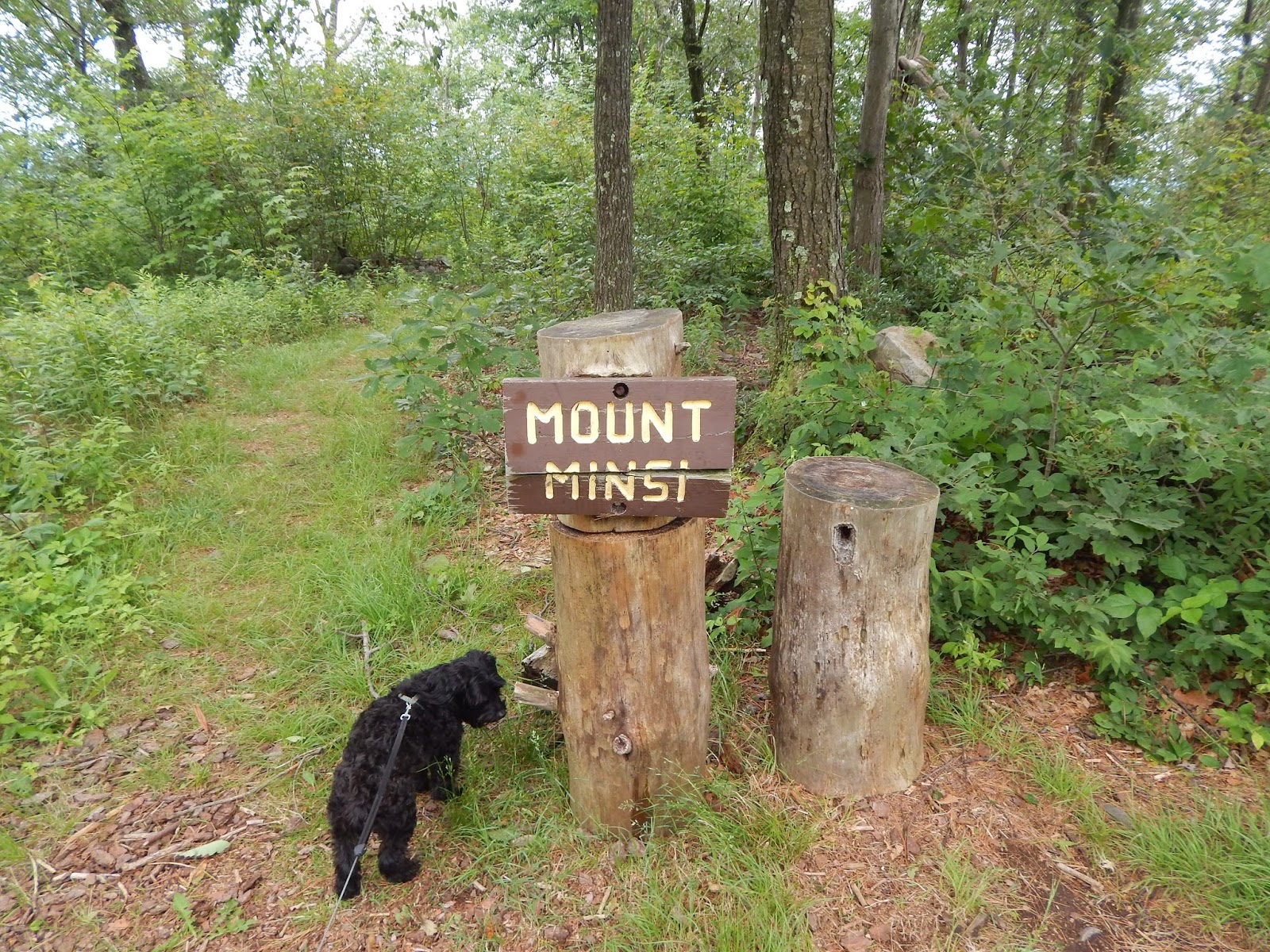
The "true summit."
Just like at the overlook, many people stopped and turned around at the view of Mt. Tammany. Only a small handful of people felt like going to the top of Minsi, but it really isn't that much farther. Like I said, I always find that sense of accomplishment worth it.
Once you've reached the "Mount Minsi" sign, there's nothing to do but re-trace your steps (or follow the fire road, if you like). Now that I think about it, I actually think the reason I didn't take the fire road was because what looked like an entire summer camp worth of children (literally, it was a summer camp) was also on the fire road. So if my memory serves, I quickly hopped from the very beginning of the fire road back onto the AT after remarking to a camp counselor (for which I have infinite sympathy, being myself a camp counselor for something like 10 out of the last 12 summers of my life) that the children would "certainly sleep well tonight." I believe she responded with something along the lines of, "That's the idea."
Coming back down offers a perspective entirely different from going up. I'm often surprised at how much I miss by not looking back when I hike. I generally only do it when I feel that twinge of paranoia about who (or what) is following me. Maybe I'll need to get into the habit, for views like some of those below. In addition to the views, I saw some pretty cool wildlife! I always love seeing snakes, in particular.

Last view of Tammany on the way back down.

A rather large snake friend!
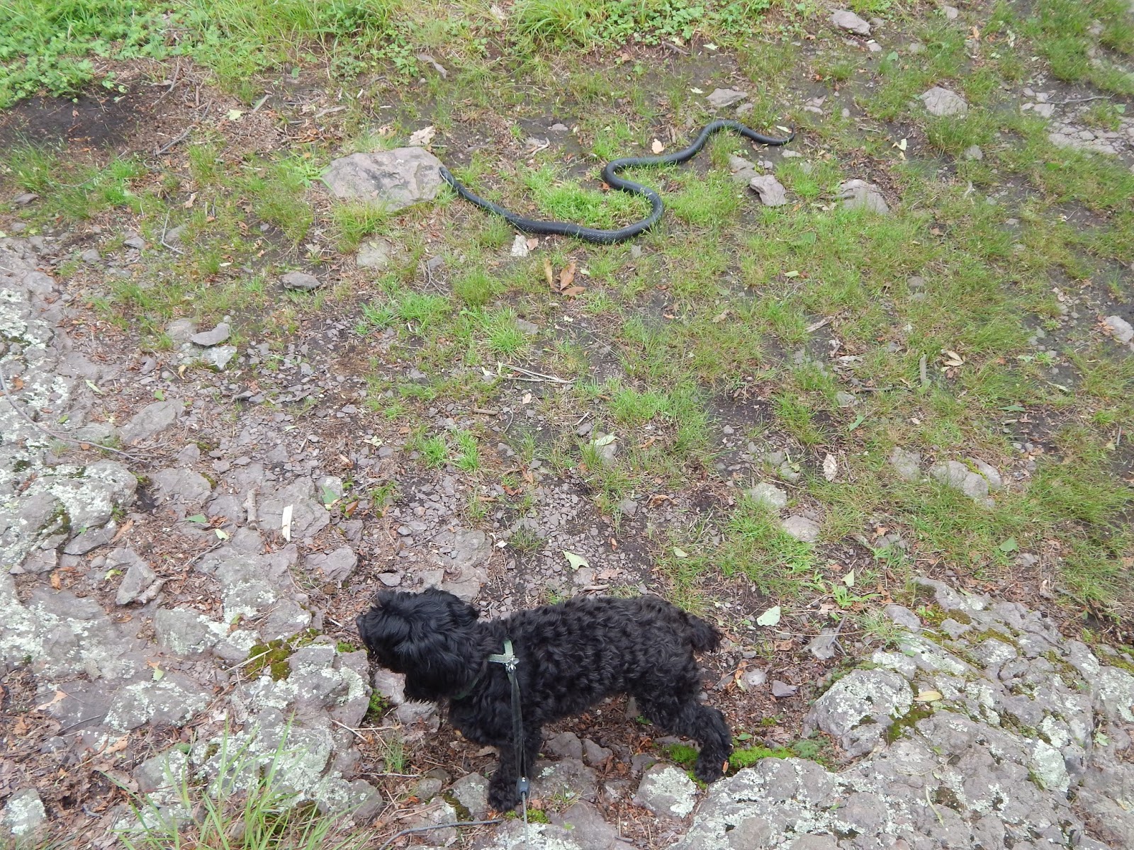
Cleo the Oblivious.


Helpful.

Aww chipmunk.
And that is it! The trail is straightforward because it's the AT, which is pretty much always easy to follow. If you're in the mood for a hike, it's always a good idea to find yourself on the Appalachian Trail. Keep on wandering!


