Season Visited: Summer
Trail Length: 3.5-mile loop
Time to Hike: 3 hours
Difficulty Level: 4
Worthington State Forest houses some of the best hiking in New Jersey. Located in the Delaware Water Gap, the beauty of the area is really spectacular. Trails are well-marked and easy to follow, and the destination is extremely popular, especially on weekends.
I decided to do a solo hike (well, my dog was with me) up Mt. Tammany on a Sunday, following the Red Dot (Tammany) Trail up the mountain and the Blue Trail down, which turned out to be a wonderful way to hike the mountain. You can see these trails marked on this map as number six and number five.
I parked at the area right off of Rt. 80 (coming from the south) that is just before the Dunnfield Creek Natural Area parking lot. At the end of the parking lot is a little area with picnic tables and trash cans, though by Sunday the place was pretty much trashed. This is a very popular weekend hike, and you have been warned that there will be crowds of people. Also, you might want to get there as early as possible, or you can kiss any parking goodbye. By the time I was finished my hike (around 2 p.m.) there was not one single parking spot in any of the four parking areas around the trailhead. I was lucky to get a spot at 11:00.
Right next to the picnic tables are the beginnings of three trails. For this hike, you want to take the first trail (the one with the stairs closest to the parking lot). This is the Red Dot Trail. Immediately you begin your uphill ascent, first by stair, and then just by rocky hill.
One of the more mild ascents in the beginning of the trail.
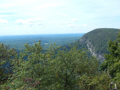
You soon hit rock scrambles. They are not unmanageable, but they are challenging. Fortunately, you are rewarded with a lovely lookout only half a mile into your hike.
The Delaware River, looking rather beautiful this far north.
The trail from this point on is really just rocks and rock scrambles. It is not easy hiking. Luckily there is only a mile to go until you reach the top.
A welcome break from the rock scrambles, this pretty section of the trail is just plain old rock.
Before you know it you are at the summit, and the views are beautiful. Be sure to check out the little nooks and crannies that give you great views of Mt. Minsi just over the border in Pennsylvania.
Me and Cleo at the top.
Mt. Minsi
Lots of people enjoying the view.
Just past these views you stop following the Red Dot and begin your descent on the Blue Trail.
The Blue Trail is quite different from the Red one and is much easier. The two miles down are more gradual but no less beautiful. On the way you'll see different vegetation and will eventually come to a cute little waterfall.
The waterfall is a popular destination.
Just past the waterfall and a wooden bridge is where you connect with the Appalachian Trail for about half a mile. This returns you to the Dunnfield Creek Natural Area parking lot. If you didn't park here, just follow the road back to your parking area.
The AT's classic white blaze.
Obviously, Mt. Tammany is a great day hike. It only takes a few hours and you get some spectacular scenery. Drawbacks are the crowds and the close proximity of the highway, but the hike is definitely worth it despite these things. You might even make some friends on the trail!
Enjoy your hike, and keep wandering.


No comments:
Post a Comment