Sunday, September 18, 2016

Mount Kineo - Carriage Trail

Location: Mount Kineo, Moosehead Lake, Maine
Season Visited: Summer
Trail Length: 5.4 miles there-and-back
Time to Hike: 3 hours
Difficulty Level: 2 out of 5

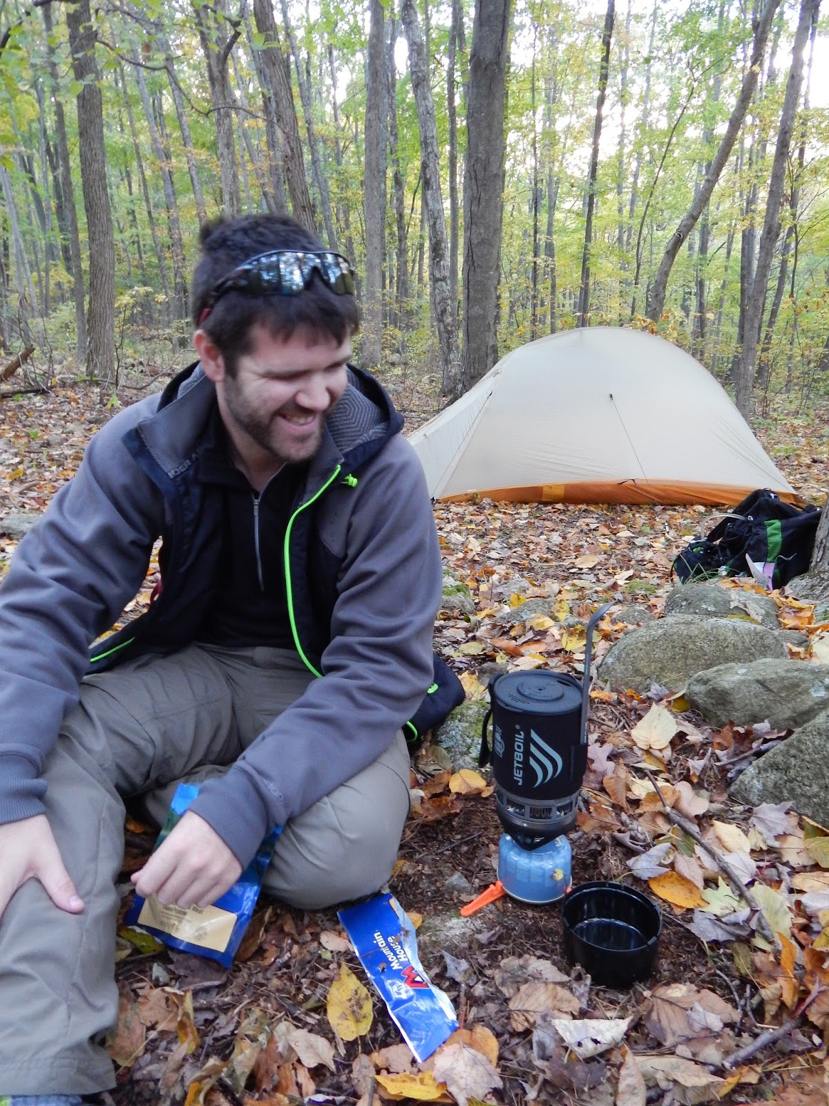
I revisited Mount Kineo three weeks ago, and instead of taking the beloved Indian Trail up the mountain, I walked the length of the island with my husband and parents on the Carriage Trail.

As noted in my previous post about Kineo (linked above), the only way to get to the mountain is by boat.  All of the information is the same as it was three years ago, except that the price per person was jacked up to $12.  Or you can take your own boat, if you have one.  Donations at the island are encouraged, but I've never seen anyone actually pay.

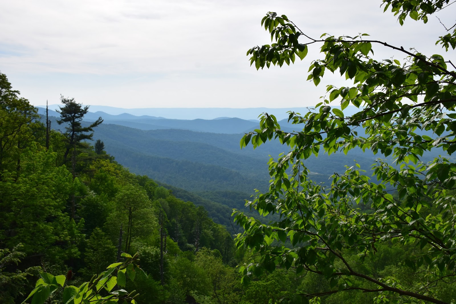
From the dock, the Carriage Trail is on your left.  It's the only trail there, so you can't get lost!  In front of you is the majestic Mount Kineo.


The most dramatic view of the mountain is the first one.  After that you'll be spending time following the edge of the lake with the mountain on your right-hand side until it sinks into the forest.  On the map below you can see the Carriage Trail on the western edge of the island.


You'll pass through a variety of environments on your walk.  The trail begins with gravel, but eventually becomes a thinner dirt trail (around the time you pass Bridle Trail on your right) and sometimes a mud trail covered with thin boards.  Navigating the boards can be just a little tricky, as they are in pretty rough shape.


Rock slide.

The trail has blue blazes.


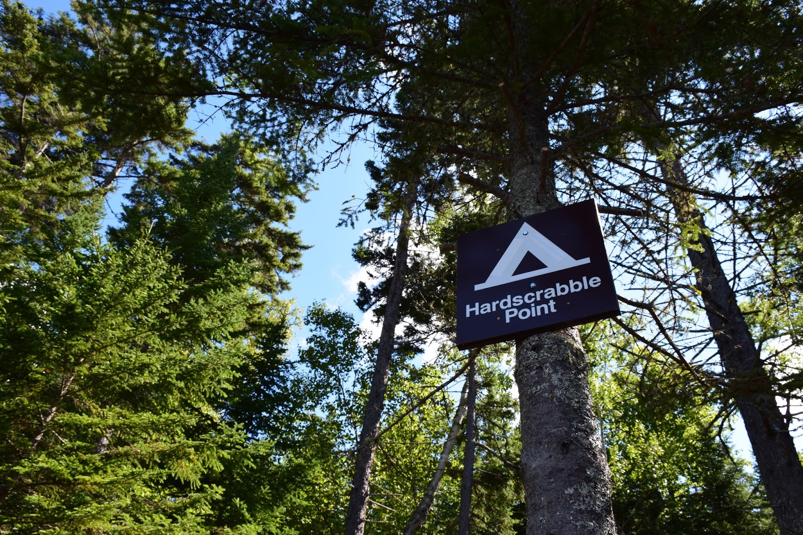
The end of Carriage Trail is Hardscrabble Point, featuring camping and even a primitive toilet!  Good times!


The way back is simply retracing your steps.
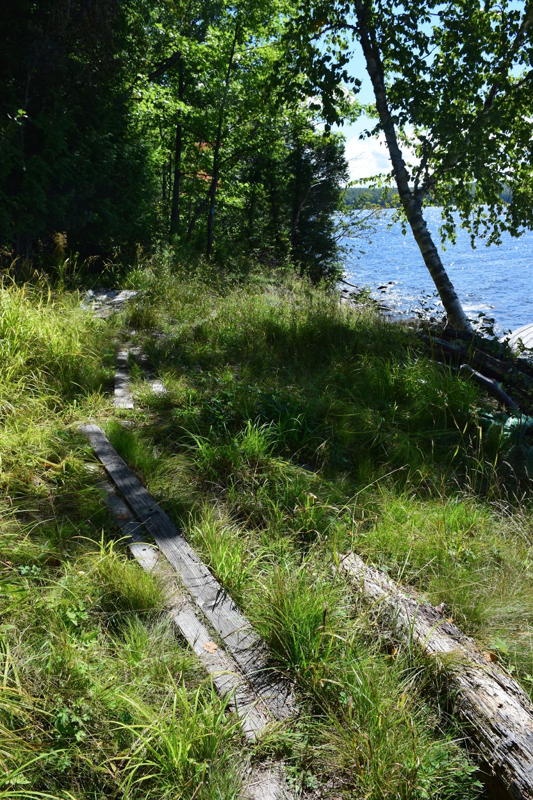
More boards.


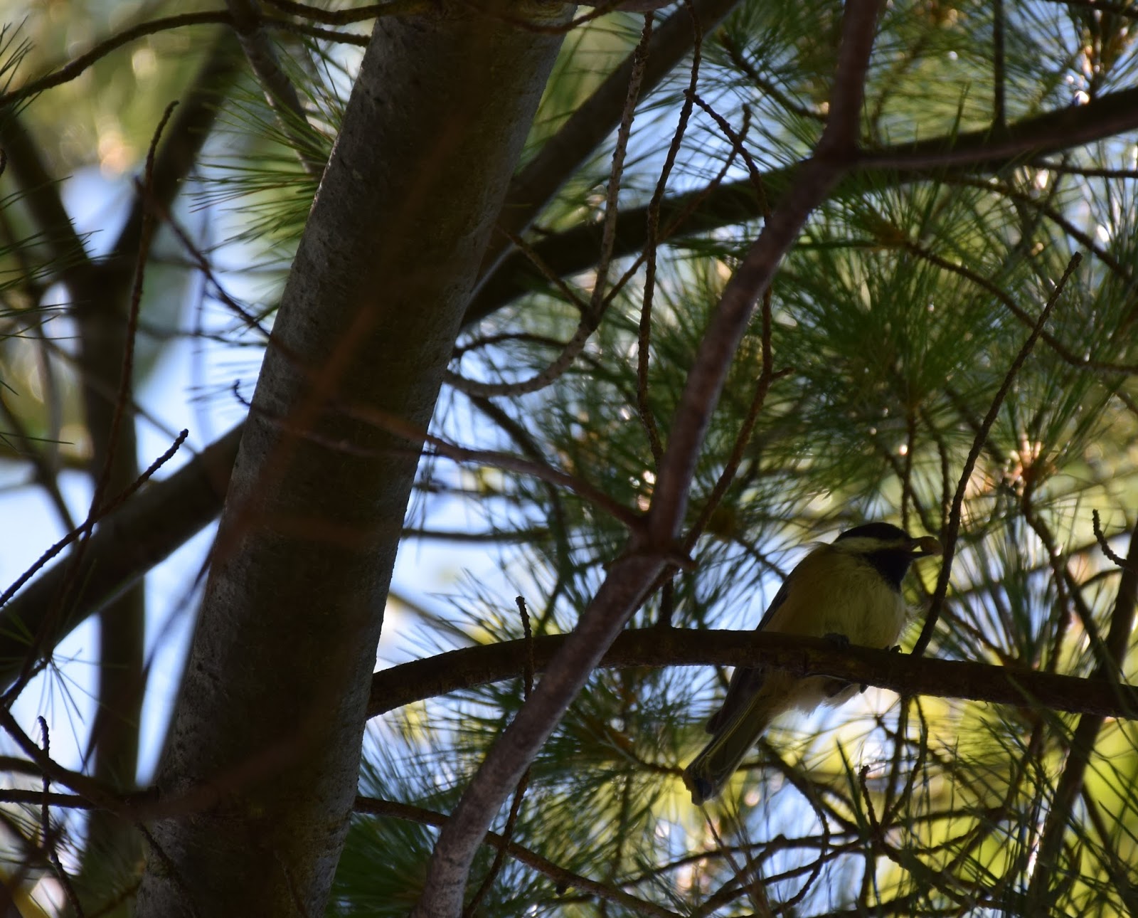
You might even get lucky and see Maine's state bird, the adorable black-capped chickadee!

Overall, this is a very nice hike with lovely views throughout, and is a good way to explore the Kineo area if you're not confident in your ability to go all the way up the mountain.  Older people often explore this trail while their younger party members climb the Indian Trail.  The length may present a challenge to a very out-of-shape hiker, but you can of course turn around at any time.  I had no issues with it at four months pregnant, but I was definitely ready for a meal afterwards!

Keep on wandering.

Saturday, August 13, 2016

Buck Pond Campground Trail - D&H Railroad Bed

Location: Buck Pond Campground, Onchiota, NY
Season Visited: Summer
Trail Length: 2.5 miles there-and-back
Time to Hike: 1.5 hours
Difficulty Level: 1

Buck Pond Campground in the Adirondacks is one of the few campgrounds I truly enjoy.  It's pretty far out there at the top of the Adirondack Park, and is therefore out of the main bustle of activity that surrounds places like Lake George or Placid.  Conveniently, it's still within easy driving distance of Placid, so food and entertainment are never too far away.  The campground itself is pretty much perfect.  It has spacious, wooded sites with relative privacy, it's nestled between two picturesque lakes, it has private trails from most campsites to the water, and it's quiet.  The only negative thing I have to say about it is that the water doesn't get very warm in the shower... or warm at all... brrrrr!

One of the best things about Buck Pond to a hiker, of course, is it's proximity to the trails.  The Adirondacks are a hiker's paradise, and I stayed at Buck Pond when making my epic ascent of Phelps Mountain in 2013.  Sean and I were looking for something much more mild one morning, so we decided to check out the easy trail along the old D&H railroad bed, part of which is housed in the campground.

Maps of the trail are not available beyond the campground map, which doesn't show more than just the beginning of it.  Since it's an easy trail, it didn't much matter to us whether or not we had a map... until we saw a poorly-marked side trail that apparently led to Little Haystack and were very curious if that was true!  We found out later from a campground worker that the trail did indeed lead to Little Haystack.  What I really want to know is whether or not you can get to the high peak Mount Haystack from there... bucket list!

Anyway, the hike begins on a blocked-off road in the campground as marked on the map, and continues in a straight line along Lake Kushaqua for 1.25 miles until hitting Lake Kushaqua/Mud Pond Road.

Start of the trail.


Lake Kushaqua.


The nice thing about this trail (and a real change of pace for me) is that it's nothing more than just a stroll.  There's no real objective here, you're just going for a walk in the woods with a lake view.  There's some nice things to see, and when you're done, you just turn around!


Common merganser and her babies.

Overall, this hike is super easy and is great for a stroll if you're staying in or around Buck Pond Campground.  It was a nice little distraction for me, but I personally can't wait until I hike my next high peak!  Keep on wandering.

Sunday, June 5, 2016

Lewis Falls

Location: Shenandoah National Park, Virginia
Season Visited: Spring
Trail Length: 2 miles there-and-back
Time to Hike: 1.5 hours
Difficulty Level: 3

Last week I went with my husband and my friend to Shenandoah to check out a waterfall I hadn't seen before: Lewis Falls.  At 81', Lewis Falls is one of the taller waterfalls in the park, and is the fourth of the big, named waterfalls that I've seen there.  The hike was enjoyable on a warm, late afternoon and was also a bit of a workout!

On this map of the Big Meadows area, you can see Lewis Falls to the left.  We parked at the lot on the left going southbound on Skyline Drive, past mile marker 51.  From there we crossed Skyline Drive to the trailhead, which begins as a gravel fire road before becoming a dirt trail.

Gravel road.

On the way is a mysterious door (probably enclosing some sort of facility for all of the human activity around Big Meadows, but which caused much more imaginative speculation amongst our party), some non-potable water (well-marked), and a steady downhill trek to the falls and views.


Past this lookout point is the observation deck for the falls.  It offers a very nice view, though I decided to press on a bit and head down the ridge for a different perspective.  The falls are impressive and are a lovely photo op.


The way back is simply retracing your steps, though it is a bit harder going up than coming down!  I paid special attention to the little critters on the way back up.

Voyeuristic bug-mating photo.

Little lady on the gravel road.

A waterfall is always a fun reward for a hike.  With an hour-and-a-half of work, we saw some beautiful sights.  Keep on wandering!

Saturday, May 14, 2016

Corbin Cabin and Nicholson Hollow

Location: Shenandoah National Park, Virginia
Season Visited: Fall
Trail Length: 4-mile loop (1.3 miles Day One; 2.7 miles Day Two)
Time to Hike: 2 days
Difficulty Level: 2

Early in October of last year, I set off with my husband to do a moderately easy overnight hike in Shenandoah.  This trail features a beautiful babbling brook and some old cabin ruins, as well as the still-standing Corbin Cabin from 1909.  The fall colors were really starting to shine and the weather was perfectly chilly on this lovely autumn weekend.

I followed this itinerary and used this map to get an idea of where I wanted to go.  We began our hike in the parking area just before mile marker 38, on the right-hand side of Skyline Drive, crossing the road immediately onto the Corbin Cabin Cutoff Trail.  This goes 1.3 miles down into the Hollow, ending at the Hughes River stream crossing.

The beginning of Corbin Cabin Cutoff Trail.


Debris in the way.


Cabin ruins.


Hughes River stream crossing.

The itinerary recommends turning left and finding a place to camp downstream, and there are definitely plenty of nice camping spots down there.  The rangers told me before the hike, however, that there was also some nice camping just beyond Corbin Cabin, so Sean and I continued on across the stream.  Once across, Corbin Cabin was straight ahead of us.  After checking it out, we continued on the trail that turns right after crossing the stream.  I believe this is Indian Run Trail, but it's really only a connection to the Nicholson Hollow Trail for the purposes of this hike.  Up beyond Corbin Cabin on this trail is a nice clearing where we set up camp.

Looking at Hughes River from the other side.

Corbin Cabin.  Some folks had rented it for the night.

Camp.

Dinner time!


Heading back down to the stream to get water for the evening.

The night spent near Corbin Cabin was relaxing and thankfully uneventful.  As fun as it is to have crazy backpacking night stories, it's nice to enjoy those rare occasions when you actually make it through an entire night without being woken up by animals, cold, storms, etc.  This night was one of the peaceful ones.

The next morning was the hike back up Nicholson Hollow Trail, which took us to Skyline Drive.  From there we took the short connecting trail to the Appalachian Trail, northbound, which led us right back to our car.

Good morning!

Another stream crossing on Day Two.


Catching mountain glimpses through the trees.


The most enjoyable part of the second day was seeing the distant mountain skyline through the turning trees.  Though somewhat uphill, the hike is not difficult.  Overall, the hike to Corbin Cabin is both peaceful and interesting.  The cabin ruins provide a reminder of Shenandoah's rich (and still, to some, controversial) human history, while the trees and streams in this designated wilderness area offer the beauty of deep woods without an overly long trek.

Enjoy the hike, and keep wandering.