Showing posts with label National Parks. Show all posts

Sunday, June 5, 2016

Lewis Falls

Location: Shenandoah National Park, Virginia
Season Visited: Spring
Trail Length: 2 miles there-and-back
Time to Hike: 1.5 hours
Difficulty Level: 3

Last week I went with my husband and my friend to Shenandoah to check out a waterfall I hadn't seen before: Lewis Falls.  At 81', Lewis Falls is one of the taller waterfalls in the park, and is the fourth of the big, named waterfalls that I've seen there.  The hike was enjoyable on a warm, late afternoon and was also a bit of a workout!

On this map of the Big Meadows area, you can see Lewis Falls to the left.  We parked at the lot on the left going southbound on Skyline Drive, past mile marker 51.  From there we crossed Skyline Drive to the trailhead, which begins as a gravel fire road before becoming a dirt trail.

Gravel road.

On the way is a mysterious door (probably enclosing some sort of facility for all of the human activity around Big Meadows, but which caused much more imaginative speculation amongst our party), some non-potable water (well-marked), and a steady downhill trek to the falls and views.


Past this lookout point is the observation deck for the falls.  It offers a very nice view, though I decided to press on a bit and head down the ridge for a different perspective.  The falls are impressive and are a lovely photo op.


The way back is simply retracing your steps, though it is a bit harder going up than coming down!  I paid special attention to the little critters on the way back up.

Voyeuristic bug-mating photo.

Little lady on the gravel road.

A waterfall is always a fun reward for a hike.  With an hour-and-a-half of work, we saw some beautiful sights.  Keep on wandering!

Sunday, March 1, 2015

South River and Pocosin

Location: Shenandoah National Park, VA
Season Visited: Fall
Trail Length: 8.6 miles (about 3.8 miles on Day One and 4.8 miles on Day Two)
Time to Hike: 2 days
Difficulty Level: 4

Shenandoah National Park in November is a VERY different place than it is in October.  If you recall from my previous post, the park is a zoo in October.  After the first week of November, it really felt like a ghost town.  It might also have had something to do with the fact that I went on a weekday and that it was raining, but I could not believe how few people I saw during my overnight backpacking trip.  Fortunately, that's just the way I like it.

I followed this itinerary and this map for my trip.

The hike starts at the South River Picnic Area.  This place has a ton of parking, so finding a spot is not a concern for this hike.  There are picnic tables and even a bathroom at the trailhead, so you can have one last snack and potty break before you start eating in the dirt and peeing behind trees.

On the day I went I was lucky enough to spot an absolutely amazing rainbow on Skyline Drive in between storms, so here are some pictures of that!


After taking in the views and parking, hike South River Falls Trail.  I've visited this trail before (twice, actually) and wrote about it here.  The part that leads you to the lookout is relatively easy, although of course it was muddy in the November rain!  The overlook for the 83-foot falls is one mile in to the hike.  You can get to the base of the falls by going a little farther.  The trek down to the base is steep and strenuous, especially on the way back up, and is not counted in the overall mileage. Due to this and the mud issues I was having, I decided not to make the trek.  It is absolutely worth it in nice weather and if you haven't seen it before, however.

Hiking to the falls.

A few fall colors left.


Looking to the falls.

Just past the lookout it went from cloudy to sunny, but then went right back to pouring rain after this.

After completing South River Falls Trail, turn left to connect to the South River Fire Road, and then turn right on the fire road.  I've written about how soul-crushingly awful this fire road is before, but I only had to hike a mile of it this time, so I made it through in relatively high spirits.  After this you turn left on Pocosin Trail and find a place to camp. The trail widens out before narrowing down again, and it is relatively easy to find a spot.


It's fun to see the falls, but I really found the second day of this hike to be the true highlight.  The rest of Pocosin Trail the next day is really interesting.  The trail is quiet and filled with history.  I came in close proximity to a beautiful deer, who didn't mind at all that I was in his foraging grounds.  The best part is the Mission Ruins at the end of Pocosin Trail, before you turn left onto Pocosin Road.  Sadly, my camera died that morning right after I woke up (I didn't realize non-lithium batteries couldn't survive near-freezing temperatures) and I couldn't get pictures of the ruins.  They are really neat, however, and are well-worth the trip. You can find some pictures of them on this site.

I did manage to take a few photos with my phone on the Appalachian Trail, however (not sure why I didn't think of that sooner), which is where you end up after Pocosin Road with a sharp left turn.  If you look up and to your left just before intersecting with the AT, you will see the PATC Pocosin Cabin, which offers a very slight short cut.  Even in the nasty November weather, there was a group of people relaxing in the cabin after an overnight stop, and there were actually quite a few people on the AT itself.  The AT continues back almost the entire way to the picnic area, before you make a quick right and end up right where you started.

Beautiful Appalachian morning after the storm.

A little climb on the AT.


Overall I found this to be a very nice overnight backpacking trip.  It's not outrageously strenuous but it certainly gives you a work out!  I must have a soft spot for the falls, because I seem to keep returning to them.  November in Shenandoah is a great time to find solitude, but remember to prepare for the weather.  November nights in the mountains are freezing - sometimes literally.  It is generally the last month I'll venture out into the wilderness without specialized, four-season equipment, and I'm always sure to have all the proper layers and gear.

Be prepared, savor the wilderness no matter what the weather, and never stop wandering.

Saturday, April 26, 2014

White Rocks (Hazel Mountain and White Rocks Trails)

Location: Shenandoah National Park, VA
Season Visited: Spring
Trail Length: Between 5 and 8.5 miles there-and-back, depending on where you camp and how long you stay on the side-trail to the falls and cave.  In this review, I estimate we hiked about 5 miles total.
Time to Hike: 3 hours (an hour and a half each day)
Difficulty Level: 2.  Side trail to waterfall and cave near camp is a very short .2 miles, but it is steep and I would rate the climb back up a 4.

My love for Shenandoah National Park cannot be overstated, as I think I have made clear on this blog.  It seemed fitting that my first real backpacking trip would be at the park that houses my favorite hike, so that's where I went!  I chose a short, easy hike with my husband for my first time sleeping outdoors anywhere other than a campground.  It was everything I hoped it would be: quiet, lovely, and a perfect location for me to test my new backpacking gear and skills.

I found out about this trail combination through Shenandoah's wonderful trip planner, which I plan to use for pretty much all of my future backpacking excursions in the park.  Be sure to get a free backcountry camping permit from the visitor center during office hours (9:00-5:00).  The park staff are always friendly.  They will ask you about your trip plans to be sure you are prepared, get a little info, and then send you on your way.

View from the Dickey Ridge Visitor Center, where you can get your permit if coming in from the North Entrance.

As stated on this useful itinerary, parking for the White Rocks trip is near mile marker 34, the Meadow Spring Area, on Skyline Drive.  There isn't a ton of parking, but there's enough.  You can see the parking area indicated on this map.

To begin the hike, head southeast on Hazel Mountain Trail from the parking area.  You will be going downhill at a nice, gradual pace.  Stay right when you come to the fork to stay on Hazel Mountain Trail.  Every intersection is clearly marked by posts as well, so it's really quite difficult to get lost.

Sean on Hazel Mountain Trail in the late afternoon.

And me.

Eventually you will come to another intersection, with a small stream on your right.  Turn left to begin on White Rocks Trail, which is, in my opinion, prettier and more interesting than the beginning of Hazel Mountain Trail.  You only have a short while to go until you reach some lovely camping spots at the cave/falls junction.

Slight uphill section on White Rocks Trail.

It's easy to forget you're up pretty high!

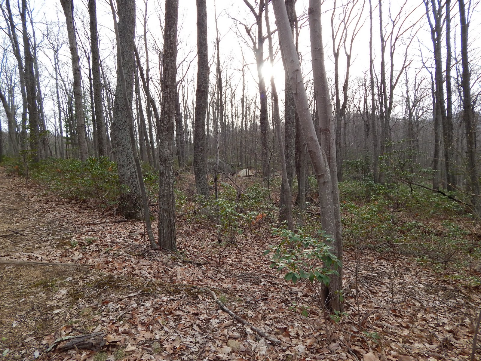
You can't miss the cave/falls junction, which is clearly marked by a post.  White Rocks Trail continues in front of you, and the side trail (unmarked on the map) to the falls and cave is to your right.  To your left, right past some brush and a boulder, are some nice camping spots.  We set up camp before heading to check out the falls and cave.

Setting up camp in my new tent with my new sleeping bag :)

The trail down to the falls is short and steep.  It's totally worth it, as the falls and cave are super fun to explore.  The cave, as the ranger at Dickey Ridge said, is really just "a hole in the wall," but it's fun anyway.

Near the bottom of the falls.


The cave is up a very short ways, right next to the falls.

Exploring the falls is lots of fun!


At the top.


Slip around the boulders by the falls for crevices to play in.

When you're done at the falls, brace yourself for a steep (but very short) climb back to camp.

Heading up!

The evening spent at camp was really lovely in mid-April.  With nobody around, everything was peaceful.  Unfortunately I (yet again) underestimated how freaking cold it gets up there in the mountains at night, but I made it through!

Taking a walk a little further down White Rocks Trail after dinner.  Campsite from the trail.

Sunset at camp.

Backcountry permit hanging from the tent, as instructed.  Unfortunately I am the lightest sleeper known to man and took it off in utter frustration at the sound of it blowing in the wind in the middle of the night.  I'll figure out a better method next time.

If you're anything like me, you'll be up at the crack of dawn the next day.  After a quick breakfast, Sean and I were back on the trail before the sun was even fully up.  I must say it looked even more beautiful in the morning light.  The hike back is more uphill, but it's really no big deal.  Just re-trace your steps and you'll be back to the parking area in no time!

White Rocks Trail in the morning.

Sun coming up at the intersection of White Rocks and Hazel Mountain.

Just after the fork almost back to the parking lot.  Buck Ridge Trail to the right and Hazel Mountain to the left on that one.

#selfie

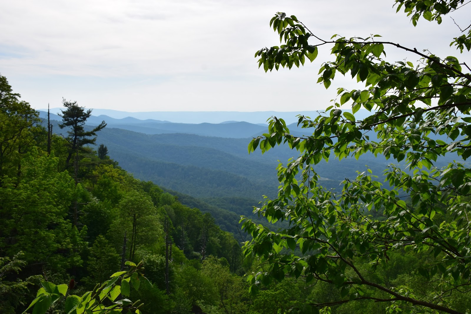
And that's it!  If you're lucky, you might even get to see some Shenandoah deer on the way home.  Oh, and don't forget to stop at those overlooks on Skyline Drive!  They never get old.

I'm just saying, I'm proud of this really nice deer picture.

How can you not love Skyline Drive?

Enjoy your hike, and keep wandering :)

Pinterest