Showing posts with label waterfall. Show all posts

Sunday, June 5, 2016

Lewis Falls

Location: Shenandoah National Park, Virginia
Season Visited: Spring
Trail Length: 2 miles there-and-back
Time to Hike: 1.5 hours
Difficulty Level: 3

Last week I went with my husband and my friend to Shenandoah to check out a waterfall I hadn't seen before: Lewis Falls.  At 81', Lewis Falls is one of the taller waterfalls in the park, and is the fourth of the big, named waterfalls that I've seen there.  The hike was enjoyable on a warm, late afternoon and was also a bit of a workout!

On this map of the Big Meadows area, you can see Lewis Falls to the left.  We parked at the lot on the left going southbound on Skyline Drive, past mile marker 51.  From there we crossed Skyline Drive to the trailhead, which begins as a gravel fire road before becoming a dirt trail.

Gravel road.

On the way is a mysterious door (probably enclosing some sort of facility for all of the human activity around Big Meadows, but which caused much more imaginative speculation amongst our party), some non-potable water (well-marked), and a steady downhill trek to the falls and views.


Past this lookout point is the observation deck for the falls.  It offers a very nice view, though I decided to press on a bit and head down the ridge for a different perspective.  The falls are impressive and are a lovely photo op.


The way back is simply retracing your steps, though it is a bit harder going up than coming down!  I paid special attention to the little critters on the way back up.

Voyeuristic bug-mating photo.

Little lady on the gravel road.

A waterfall is always a fun reward for a hike.  With an hour-and-a-half of work, we saw some beautiful sights.  Keep on wandering!

Sunday, March 20, 2016

Glen Onoko Falls

Location: Lehigh Gorge State Park, Pennsylvania
Season Visited: Spring
Trail Length: 5.9 miles there-and-back
Time to Hike: 4 hours
Difficulty Level: 4

Right before last year's summer solstice I went with some friends to check out the Glen Onoko Falls trail in PA.  The trail has a similar feel to the Ricketts Glen Falls Trail but is lesser known and therefore less crowded.  Always a plus!

The hike begins in a parking area with these GPS coordinates: 40.883555 -75.760422.  The problem with this trail is that it's very difficult to find a map, so I don't have one to show you.  If you go you'll just have to have a sense of adventure.  My friends and I took a wrong turn a few times on the trail, but eventually found our way to the lovely waterfalls.

The Glen Onoko Trail sign is almost exactly the same as the one at Ricketts Glen.

At the start of the trail the difficulty level is easy.  It passes under some railroad tracks and offers some interesting graffiti, as well as a view of a lake.

Didn't think you'd see Batman on this hike, did you?


The trail then takes a short but steep climb up to where the waterfalls begin and turns quite a bit rockier than before.  Fortunately, you are rewarded with lovely waterfall views in rapid succession.


On a warm day, it is basically impossible not to take a dip!


Past this fun waterfall (the first "big one") is another, this one much taller than the one before.


The trail goes up and around the waterfall to the right, taking you directly passed the main body of the falls.  This is an excellent photo op!


The trail then leads you to the top of the falls.  On the way, you will pass a series of interesting cairns and wind around the rocks.  At the top is an absolutely amazing view, but beware - you will have to break some rules if you want to see it.  At least on the day I went, the view from the top was roped off.  It is exceptionally slippery and it's easy to see how one could take a fall - with fatal results.  In fact there is a ghost story about the top of this waterfall, rather like a tragic Pocahontas story.  The tale goes that a young Native American princess fell in love with a white man who settled in the area.  When the love was discovered by her father, he had the man thrown off the top of the waterfall.  His daughter, overcome by grief, jumped off to join her lover in death.  The daughter's name was Onoko, giving the glen its name: Glen Onoko.

Cairns.

Winding around.

Just beyond the ropes at the top.

A relaxing spot worth breaking the rules for.

Above this waterfall is yet another beautiful cascade, this one surrounded by trees and rhododendron.  It seems that with every uphill step you take on this hike you come across another waterfall, until it suddenly ends.


Looking down.


After this last cascade the trail veers right and takes you into a pretty forest filled with undergrowth.  It looks like a bear's paradise, and those I was travelling with were far more anxious than I was about the possibility of meeting one.  We therefore hiked quickly to the end of the trail, simply staying to the right when presented with a fork.  The way down is less interesting, unless you count this millipede as exciting.  But I'm pretty sure that's just me.


And that's the trail!  Overall, I thought this trail was lovely and would definitely do it again, especially when in the mood for a waterfall swim.  My only reservation is that information is hard to come by, and I dislike not having a reliable trail map.  But it's (relatively) close to home for me, so I'm sure I'll be back!  Keep on wandering, friends.

Tuesday, August 25, 2015

Laurel Prong and Hazeltop

Location: Shenandoah National Park, VA
Season Visited: Spring
Trail Length: 7.4 miles (about 4.3 miles on Day One and 3.1 miles on Day Two)
Time to Hike: 2 days
Difficulty Level: 2

I completed my first backpacking trip of 2015 back in the first week of April, and then had such a good time that I went back again two weeks later with my husband and my dog!  This hike is a great backpacking trip for beginners in moderate shape.  It's enough to give you a workout but not enough to exhaust you.  If I was ever taking a complete beginner on a trip, this would definitely be one of my go-to trails.

I used this itinerary and this map for my trip.

The hike starts at Milam Gap parking, between mile 52 and 53 of Skyline Drive.  It's a good-sized parking lot and finding a spot was not an issue at all.  Cross Skyline Drive pretty much immediately to head south on the Appalachian Trail.

AT post after crossing Skyline Drive.

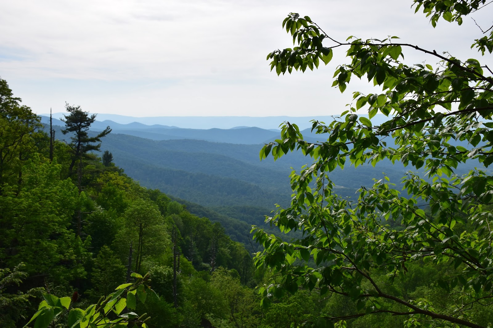
Hike the AT for 2.6 miles and then turn left on Laurel Prong Trail, where you will be sleeping for the night.  Everything is well-labeled and easy to follow.  I always check the posts, even if I know where I'm going, to ensure I'm never lost.  There are some beautiful views of the mountains, if you look for them.  The first time I hiked this trail I totally missed an amazing viewpoint that my smart little dog scoped out the second time.

Cleo the hiking yorkie-poo is at it again!


Laurel Prong Trail turns sharply left at one point (you can see it on the map), taking you along a really neat ridge with rock formations.  Hiking for a while after the ridge you return to the woods, and if you're looking for it, there is a very obvious camping spot on the right-hand side of the trail.  It's just before a tiny creek crossing, so if you've come to that then you've gone too far.  This little creek beyond camp is where we filtered our water.

Ridge line - the first time.


Cleo on the ridge.

The campsite is spacious, but we did have to clear a bunch of fallen branches out of the way that were not there two weeks before.

Cleo by the creek.


The next day is exceptionally interesting.  As Sean said, the first day can be a bit boring if just walking in the woods isn't enough for you.  The second day features some awesome history at Rapidan Camp!

If you camped in the big spot on Laurel Prong trail you've got a little while before you see Fork Mountain trail go off to your right (which you bypass).  In the spring, the trail can definitely be wet, but if you're hiking this time of year you're probably already prepared for that, right?

Wet, early morning trail.

The intersection with Fork Mountain.  You can't camp past this point.

Follow Laurel Prong along and you will come to the really cool Rapidan Camp.  Explore the area!  There are neat historical buildings, both a wooden and metal bridge, and a waterfall.  During normal hours I think they have rangers and exhibits there, but I was either way too early in the morning or too late in the evening when I went.  Personally, I very much enjoyed the solitude.


There's also this little trail called Five Tents Trail that spurs off of Laurel Prong.  It's really short but steep if you're already a little winded, and to be honest there's really nothing there but an old foundation.  I guess if you're into foundations then, by all means, go check it out, but there's nothing you didn't already see at the Camp itself.

When you've had enough, find Mill Prong trail.  It was a little hard for me to find at first but once I saw the post it was pretty obvious.  Just look for the metal bridge.  It's right around there.  FYI - there is an outhouse past the metal bridge (which I did not take a picture of, sorry).  That outhouse was NOT stocked with toilet paper at the time I went, even though it had a dispenser.  And that was really unfortunate, because the second time I went I ran out of toilet paper.  And had to use a leaf.  So yeah, just so you know.

Post at the beginning of Mill Prong.

Waterfall on Mill Prong Trail.

Stones to cross, in front of the waterfall.

So, you may or may not know this, but one of Shenandoah's most magical features is the large-flowered trillium that blooms in the park between March and May.  It is the park's logo and is a spectacular flower.  The first time I made this trip in the first week of April, the trillium had not yet bloomed.  But in the middle of the month it was all around this waterfall.  Seeing trillium in Shenandoah is one of my favorite things and the blooms around the waterfall were just gorgeous.

Large-flowered trillium.


Past the waterfall a bit you will see the split for Mill Prong and the Mill Prong horse trail.  Be sure to stay left on Mill Prong, because the horse trail ends up very out of your way!  After that you will encounter two stream crossings, neither of which is daunting.  Finally, the brush will change and you will make your way up a small rise back to Skyline Drive and the parking area.

Mill Prong and Mill Prong horse trail split.

First stream crossing.

Second stream crossing.

Slight incline at the end of the trail.

And that's the hike!  Remember on your drive home to keep an eye out for deer on Skyline Drive.  They're EVERYWHERE.  And keep on wandering :)