Season Visited: Spring
Trail Length: 7.4 miles (about 4.3 miles on Day One and 3.1 miles on Day Two)
Time to Hike: 2 days
Difficulty Level: 2
I completed my first backpacking trip of 2015 back in the first week of April, and then had such a good time that I went back again two weeks later with my husband and my dog! This hike is a great backpacking trip for beginners in moderate shape. It's enough to give you a workout but not enough to exhaust you. If I was ever taking a complete beginner on a trip, this would definitely be one of my go-to trails.
I used this itinerary and this map for my trip.
The hike starts at Milam Gap parking, between mile 52 and 53 of Skyline Drive. It's a good-sized parking lot and finding a spot was not an issue at all. Cross Skyline Drive pretty much immediately to head south on the Appalachian Trail.
AT post after crossing Skyline Drive.
Cleo the hiking yorkie-poo is at it again!
Ridge line - the first time.
Cleo on the ridge.
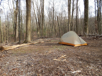
The campsite is spacious, but we did have to clear a bunch of fallen branches out of the way that were not there two weeks before.
Cleo by the creek.
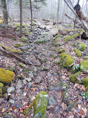
If you camped in the big spot on Laurel Prong trail you've got a little while before you see Fork Mountain trail go off to your right (which you bypass). In the spring, the trail can definitely be wet, but if you're hiking this time of year you're probably already prepared for that, right?
Wet, early morning trail.
The intersection with Fork Mountain. You can't camp past this point.
Follow Laurel Prong along and you will come to the really cool Rapidan Camp. Explore the area! There are neat historical buildings, both a wooden and metal bridge, and a waterfall. During normal hours I think they have rangers and exhibits there, but I was either way too early in the morning or too late in the evening when I went. Personally, I very much enjoyed the solitude.
There's also this little trail called Five Tents Trail that spurs off of Laurel Prong. It's really short but steep if you're already a little winded, and to be honest there's really nothing there but an old foundation. I guess if you're into foundations then, by all means, go check it out, but there's nothing you didn't already see at the Camp itself.
When you've had enough, find Mill Prong trail. It was a little hard for me to find at first but once I saw the post it was pretty obvious. Just look for the metal bridge. It's right around there. FYI - there is an outhouse past the metal bridge (which I did not take a picture of, sorry). That outhouse was NOT stocked with toilet paper at the time I went, even though it had a dispenser. And that was really unfortunate, because the second time I went I ran out of toilet paper. And had to use a leaf. So yeah, just so you know.
Post at the beginning of Mill Prong.
Waterfall on Mill Prong Trail.
Stones to cross, in front of the waterfall.
So, you may or may not know this, but one of Shenandoah's most magical features is the large-flowered trillium that blooms in the park between March and May. It is the park's logo and is a spectacular flower. The first time I made this trip in the first week of April, the trillium had not yet bloomed. But in the middle of the month it was all around this waterfall. Seeing trillium in Shenandoah is one of my favorite things and the blooms around the waterfall were just gorgeous.
Large-flowered trillium.
Past the waterfall a bit you will see the split for Mill Prong and the Mill Prong horse trail. Be sure to stay left on Mill Prong, because the horse trail ends up very out of your way! After that you will encounter two stream crossings, neither of which is daunting. Finally, the brush will change and you will make your way up a small rise back to Skyline Drive and the parking area.
Mill Prong and Mill Prong horse trail split.
First stream crossing.
Second stream crossing.
Slight incline at the end of the trail.
And that's the hike! Remember on your drive home to keep an eye out for deer on Skyline Drive. They're EVERYWHERE. And keep on wandering :)


Thank you for writing such a detailed blog on laurel prong and hazeltop. My wife and I were going to go down to Big Run Portal for our first backpacking trip, but they closed it a couple weeks back due to reports of an aggressive bear. I ran through the NPS 1-night beginners trip planner and came across this hike, but went looking for someone else who has done it.
ReplyDeleteBased on everything you've written here, we're going to give it a shot this weekend!
- Michael
This is a great hike for your first backpacking trip. Have a nice time!
Delete