Saturday, April 26, 2014

White Rocks (Hazel Mountain and White Rocks Trails)

Location: Shenandoah National Park, VA
Season Visited: Spring
Trail Length: Between 5 and 8.5 miles there-and-back, depending on where you camp and how long you stay on the side-trail to the falls and cave.  In this review, I estimate we hiked about 5 miles total.
Time to Hike: 3 hours (an hour and a half each day)
Difficulty Level: 2.  Side trail to waterfall and cave near camp is a very short .2 miles, but it is steep and I would rate the climb back up a 4.

My love for Shenandoah National Park cannot be overstated, as I think I have made clear on this blog.  It seemed fitting that my first real backpacking trip would be at the park that houses my favorite hike, so that's where I went!  I chose a short, easy hike with my husband for my first time sleeping outdoors anywhere other than a campground.  It was everything I hoped it would be: quiet, lovely, and a perfect location for me to test my new backpacking gear and skills.

I found out about this trail combination through Shenandoah's wonderful trip planner, which I plan to use for pretty much all of my future backpacking excursions in the park.  Be sure to get a free backcountry camping permit from the visitor center during office hours (9:00-5:00).  The park staff are always friendly.  They will ask you about your trip plans to be sure you are prepared, get a little info, and then send you on your way.

View from the Dickey Ridge Visitor Center, where you can get your permit if coming in from the North Entrance.

As stated on this useful itinerary, parking for the White Rocks trip is near mile marker 34, the Meadow Spring Area, on Skyline Drive.  There isn't a ton of parking, but there's enough.  You can see the parking area indicated on this map.

To begin the hike, head southeast on Hazel Mountain Trail from the parking area.  You will be going downhill at a nice, gradual pace.  Stay right when you come to the fork to stay on Hazel Mountain Trail.  Every intersection is clearly marked by posts as well, so it's really quite difficult to get lost.

Sean on Hazel Mountain Trail in the late afternoon.

And me.

Eventually you will come to another intersection, with a small stream on your right.  Turn left to begin on White Rocks Trail, which is, in my opinion, prettier and more interesting than the beginning of Hazel Mountain Trail.  You only have a short while to go until you reach some lovely camping spots at the cave/falls junction.

Slight uphill section on White Rocks Trail.

It's easy to forget you're up pretty high!

You can't miss the cave/falls junction, which is clearly marked by a post.  White Rocks Trail continues in front of you, and the side trail (unmarked on the map) to the falls and cave is to your right.  To your left, right past some brush and a boulder, are some nice camping spots.  We set up camp before heading to check out the falls and cave.

Setting up camp in my new tent with my new sleeping bag :)

The trail down to the falls is short and steep.  It's totally worth it, as the falls and cave are super fun to explore.  The cave, as the ranger at Dickey Ridge said, is really just "a hole in the wall," but it's fun anyway.

Near the bottom of the falls.


The cave is up a very short ways, right next to the falls.

Exploring the falls is lots of fun!


At the top.


Slip around the boulders by the falls for crevices to play in.

When you're done at the falls, brace yourself for a steep (but very short) climb back to camp.

Heading up!

The evening spent at camp was really lovely in mid-April.  With nobody around, everything was peaceful.  Unfortunately I (yet again) underestimated how freaking cold it gets up there in the mountains at night, but I made it through!
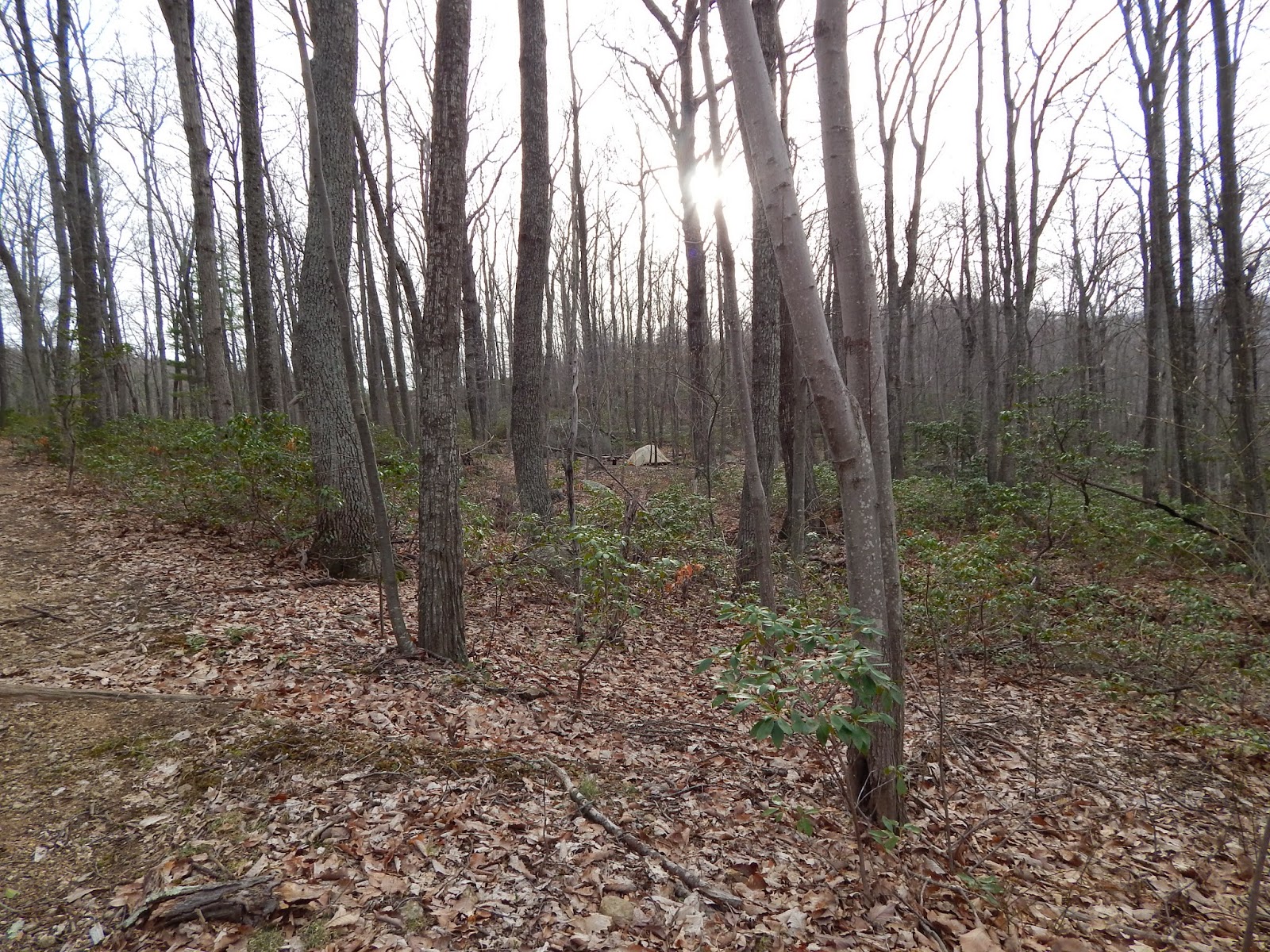
Taking a walk a little further down White Rocks Trail after dinner.  Campsite from the trail.

Sunset at camp.

Backcountry permit hanging from the tent, as instructed.  Unfortunately I am the lightest sleeper known to man and took it off in utter frustration at the sound of it blowing in the wind in the middle of the night.  I'll figure out a better method next time.

If you're anything like me, you'll be up at the crack of dawn the next day.  After a quick breakfast, Sean and I were back on the trail before the sun was even fully up.  I must say it looked even more beautiful in the morning light.  The hike back is more uphill, but it's really no big deal.  Just re-trace your steps and you'll be back to the parking area in no time!

White Rocks Trail in the morning.

Sun coming up at the intersection of White Rocks and Hazel Mountain.

Just after the fork almost back to the parking lot.  Buck Ridge Trail to the right and Hazel Mountain to the left on that one.

#selfie

And that's it!  If you're lucky, you might even get to see some Shenandoah deer on the way home.  Oh, and don't forget to stop at those overlooks on Skyline Drive!  They never get old.

I'm just saying, I'm proud of this really nice deer picture.

How can you not love Skyline Drive?

Enjoy your hike, and keep wandering :)

Pinterest

Sunday, February 23, 2014

Sunfish Pond - Winter

I went back to Sunfish Pond last week, and my goodness was it an adventure!  (See my post from September 2013 for more information about Sunfish Pond, including summer and fall photographs.)

I don't know why, but I was under the impression that despite the recent heavy snowfall the trails would be relatively clear and easy to hike.  I was only half correct, and the mistake was almost very costly.  Follow me on my adventure as an example of what not to do when winter hiking for the first time.

AT beginning.

My friend Mark and I started on the AT to Sunfish Pond without too much difficulty with the snow.  I was, however, far more out of breath than I was comfortable with, probably due to the fact that I haven't done any hiking whatsoever in two months (darn you winter!).  Still, the snow was only about three inches deep on the trail, and as long as I didn't step into the two feet of snow on the side of the trail then everything was fine.

Mark at the Sunfish Pond sign.

The snow got deep at times, but it was fine on the trail, and we made it to the pond in two hours - exactly the time I was hoping to make.

Snow up to the knees off the trail!

Beautiful snow, trees, and sky!


The pond, covered with snow.

At least near the shore, the pond was frozen solid!

After enjoying the pond is when things got crazy.  Mark and I started to get a bit chilly, so we moved on from the pond.  Had we been smart, we would have simply taken the AT back and done the trail in the four hours it usually takes.  BUT NO.  Having taken the Dunnfield Creek trail back in September, I wanted to enjoy its beauty again.  So, we started up the little hill and quickly realized that the trail was very different from the AT.  First of all, there was no definite trail, only two snow shoe tracks providing directions.  The snow was around two feet deep, and every five steps or so we fell through the top layer and into the coldness.  BUT, for some reason that I most certainly cannot explain, we decided the best thing to do would be to keep going.

And that was how we found ourselves too far to turn back, slogging through endless snow, and occasionally losing the snow shoe tracks.  Five hours later the sun started setting, and we were out of food.  We were absolutely exhausted, and our feet were dangerously wet in the below freezing weather.  Dunnfield Creek Trail involves seven different creek crossings, and the snow made it impossible to see where the crossing rocks were, resulting in a lot of falls.  Thankfully the Delaware Water Gap is one of the few places I hike that actually gets phone reception, so I was able to alert some people as to where I was - just in case.

An accurate portrayal of what this trip was like.


A little off-trail trudging to make it back.

Since I'm writing this, it's obvious that Mark and I made it through, but it was eight hours from when we started and well after nightfall (thank goodness I had a flashlight).  It was of course my own stupidity that caused the insanity, but it was a lesson well learned.  My muscles were so sore from dragging my legs in and out of the snow that I actually had to call out of work the next day, something I don't do lightly.  Next time I want to hike eight miles in the winter, I'll do a little research about the snowfall first.  Or bring some snowshoes.

j.r.r. tolkien.
Even in hardship, keep wandering.

Monday, December 23, 2013

Big Meadows Campground Review

Big Meadows Campground is one of the four campgrounds located in Shenandoah National Park.  Popular and crowded, Big Meadows is probably the worst of the three campgrounds in Shenandoah that I've stayed in, the others being Mathew's Arm and Lewis Mountain.  Although it's better than nothing, I do not recommend staying at Big Meadows.

Many people choose Big Meadows because it is very large, and therefore usually has spaces available after the other campgrounds have filled up.  It's also right around the middle of Skyline Drive, so there's easy access to lots of different places.  I stayed there for a night in September because it was the last place available on two weeks of notice, and also because it was the closest campground to Old Rag, which I hiked the next day.  I had hope that after a pretty bad first impression things would get better, but they only got worse.

I set up camp in the late afternoon after driving five hours from New Jersey.  The campsite was pitifully small, as were all the others around it (I was in the A-loop).  It was noisy, but I had been assured by the park's website that quiet hours were enforced.  To be honest I'm not sure why I believed that, because I have yet to stay in a campground anywhere where the management has enough guts to tell obnoxious people to shut up, but I held out hope for Shenandoah because it is, after all, a National Park.

Unfortunately, as the night wore on, it became obvious that no one was coming to my rescue as my noisy, drunk neighbors partied long into the night.  I consider myself a pretty serious hiker, even if I am still only a beginner, so I was anxious to be well-rested as I would be waking before sunrise to start my journey to Old Rag.  To my dismay, the group partied well past midnight, complete with yelling and music blasting from their car.  Now, I am not the kind of person to sit back and take that kind of thing.  I am a self-termed campground snob, and have no qualms about telling people to be quiet after hours and have done so on several occasions.  I didn't this time, though, for a few reasons, not the least of which being that the group had some of the most foul and even violent language coming out of their mouths that I had heard in a long time.  You usually don't get that kind of thing when you're camping, but it happened here, and I frankly felt uncomfortable confronting these people since I was by myself.

Now, it might be easy to dismiss this as just one bad experience, but, in my opinion, when the park rangers do nothing to stop a serious problem like this there is no guarantee that they ever will.  Even in spite of the noise the campground was lacking.  I try to look on the bright side of course, and even with this bad camping experience I had an absolutely wonderful time on my first solo trip to Shenandoah (see my Old Rag and Stony Man posts).  This trip just served to confirm, as so many have in the past, that staying in campgrounds simply isn't for me.  I am easing my way into solely backpacking, and can't wait until my dependency on campgrounds has completely come to an end.

If, like me, you go to nature for solitude, avoid Big Meadows at all costs.  If you get stuck there anyway, just smile and remind yourself not to do it again.  At least a bad day in nature is better than a good day stuck inside!

Absolutely love this!!!
Pinterest

Sunday, December 1, 2013

Grassland Trail

Location: Supawna Meadows National Wildlife Refuge, Pennsville, NJ
Season Visited: Spring, Summer, Fall, Winter
Trail Length: 1.5 mile-loop, estimated
Time to Hike: 40 minutes
Difficulty Level: 1

Supawna Meadows National Wildlife Refuge houses thousands of amazing birds year-round and, conveniently, is located only five minutes from my house.  With two small hiking trails, Supawna Meadows is a great place for birding and doing a little bit of hiking without having to go anywhere!  I have seen many amazing animals, insects, and arachnids here at all seasons of the year.

Since I almost live within the jurisdiction of the refuge, I visit fairly often.  The following pictures therefore are from several trips during different times of the year.

The trailhead in summer.

This particular hike begins on Lighthouse Road, a very nice drive in itself.  You can see Grassland Trail on the map in this brochure.  Your hike begins on grass (pictured above) that quickly becomes a mossy patch.  The trees are quite beautiful here.  Just a warning, however: despite its undeniable beauty, I have stopped going to Grassland Trail in the summer.  In my experience it is impossible to walk there without getting bitten by hundreds of mosquitoes and losing blood to several ticks.  I do believe it's worth going once in the summer to see the butterflies and dense vegetation, but you have been warned.


As you may be able to see on the map, you have a choice whether you go left or right on Grassland Trail.  To the left is the loop itself, and to the right is a short walk to an observation platform perfect for birding.  This trail review starts going left.

As you wind around the trees, you will notice an interesting feature on a small road that you will spend some time walking on.  This is a small graveyard.

Graveyard in the fall.  The plaque tells of the quarantining of the bodies, which were infected with smallpox.

Past this sobering little monument is the road that runs through the area.

Refuge road in the fall.

Walk down this road for a time until you see a trail to the left and to the right.  This is the loop.  You may pick whichever way you wish.  I often go to the right, which leads you to a grassy trail that runs through a tunnel of shrubbery.


This part of the trail snakes in and out of the open road (it's not open to the public, so no one's ever on it), so just keep your eye out for where the trail re-enters the brush.  Also look out for many different species of birds.  I have seen herons, hawks, and even eagles amongst countless songbirds.  In the summer the place is also covered in butterflies!


The next part of the trail goes through the open meadow.  Birds dart in and out of the tall grasses, and in the summer there are thousands of dragonflies alongside the butterflies.

There are old, unused bird-watching buildings along the trail.

Meadow in summer.

Meadow in fall.


Along the loop there are some turn-offs to explore.  One simply cuts through the meadow in the middle of the loop.  Another takes a small detour to some benches by an overgrown pond.  It was here that I once saw the caterpillar of a luna moth, which was amazing.  Once you have completed the loop, re-trace your steps down the road to the mossy path and check out the observation platform.

This is a video of the birds and scenery on the platform on a late November afternoon.  Sadly I am experiencing technical difficulties so the video will not play, but I will update it if I can!

If you are travelling to Supawna Meadows, be sure to check out other highlights while you're here.  The Forest Habitat Trail is right down the road (post on that to come), and Fort Mott State Park is only a few minutes away as well.  Enjoy your hike, and keep wandering!


Monarch butterfly by the parking area.

Sunday, November 24, 2013

Hawk Falls Trail

Location: Hickory Run State Park, Pennsylvania
Season Visited: Fall
Trail Length: 0.6 miles there-and-back
Time to Hike: 25 minutes
Difficulty Level: 2

Hickory Run State Park  is an interesting and diverse state park in the Poconos in Pennsylvania.  It has 44 miles of hiking trails ranging from very easy to moderately difficult and some amazing scenery, including its famous Boulder Field.

Sean and Cleo at the boulder field, a National Natural Landmark.

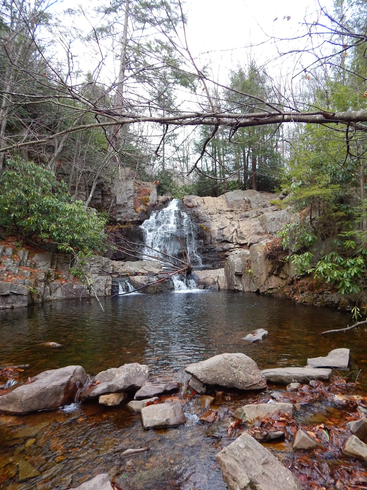
Hawk Falls Trail is short and sweet.  It's perfect for beginning hikers or when you just want to take a stroll, but still want to see a nice waterfall!  Begin your hike at the parking area just past the Rt. 476 overpass, as if you were leaving the park on Rt. 534.  Park on the right-hand side of the road and you'll see the Hawk Falls Trail sign a little to your right.  Hawk Falls Trail is letter J on this map.


The trail begins with a downhill walk through some rhododendron.  Before long you come to a bridge over a creek.  There are plenty of little places to explore off the trail.


Past the bridge, continuing on the trail.

A little further on and to the left you'll notice a rock outcropping a few feet off of the trail.  Be sure to spend some time here, because it is your first view of the 25-foot waterfall.  There are some rocks to climb on and if you're feeling a bit adventurous you can scramble down to the foot of the falls, and also around the top!


There is also a nice place to stop and look at the water of Hawk Run when you continue down the trail.


The trail then leads you through a tunnel of rhododendron and down to the foot of the falls if you haven't climbed down there already, as I did.  Again, it's fun to climb on the rocks.  I recommend climbing them back up to the outcrop instead of taking the trail back around, just for the fun of it :)


Some last pictures with the falls before heading back.

When you're done with the falls, all that's left to do is retrace your steps.


Quick and easy, Hawk Falls Trail is a nice way to spend a little leisure time at Hickory Run.  There are plenty of other trails nearby, so feel free to extend your trip!  Enjoy your hike, and keep wandering.