Friday, October 11, 2013

Old Rag Mountain

Location: Shenandoah National Park, Virginia
Season Visited: Summer
Trail Length: 9-mile loop
Time to Hike: 6 hours
Difficulty Level: 5

I'll admit it: I was skeptical that Old Rag was the hike everyone said it was.  Let me just say that I am a doubter no more.  Old Rag is quite possibly the most fun hike I have ever done.  If you are considering going whenever this wonderful country of ours decides to get its ducks in a row and let its citizens back into our greatest national treasures - the National Parks - please allow my trail review to persuade you to go the minute they open the gates.

The hike begins at a parking area outside of Skyline Drive.  The free map provided at the Shenandoah visitor center includes directions from Sperryville.  The night before my hike I camped at Big Meadows Campground (unfortunately), and the drive took me about an hour.  The drive through the countryside is absolutely gorgeous, though.

Please be advised that you must get to the parking area early in order to get a spot, as this is an extremely popular hike.  It is apparently impossible to get a spot any later than 10 am, but I've heard it can be a hassle as early as 9:00.  I got to the parking area at 7:45 after a beautiful sunrise drive and found plenty of cars there already.  Fortunately I never found my hike to be overly crowded.  The earlier you go the more crowds you'll beat.

Sunrise over Old Rag at the Old Rag lookout on Skyline Drive, the morning of my hike.

Sun rising higher.  Still on Skyline Drive.

Deer in the morning light, just off of Skyline Drive on the way to Sperryville.

Right around 8:00 a Park Ranger shows up at the parking lot to make sure that everyone has valid park passes.  Be sure to have yours if you got it at the park, or you'll need to pay again here.  I believe the fee is $15.  The rangers are, of course, very friendly and love to give tips for your hike.

To reach the trailhead of Ridge Trail, you'll need to walk about a mile up a road that begins the way up the 3,284-foot mountain.  The road alone is enough to get your blood flowing.  If you're extremely tired before you even get to the trail, you may want to think twice about attempting the hike.  Fortunately, the mile up the road (and the mile back) is included in the total mileage.

When you reach the trailhead you will really begin the ascent up the mountain.  If you think it's a bit steep and rocky now, you ain't seen nothin' yet.

Trailhead.


Not too far into the trail.  A word of practical advice: dress in layers.  8 am in the mountains is very cold, but 11:00 on a sunny late-summer peak is quite warm.  I stuffed the turtle-neck in my pack around 9:30.

Walking up the trail before you come out into the open is probably the hardest part of the hike.  Rangers warn you about the boulder scrambles, but I found them to be incredibly easy.  If you're like me, the unspeakable beauty of the mountaintop will send adrenaline coursing through your veins, and scrambling the boulders will be a breeze.  I find that uphill inclines without much change of pace are the hardest both physically and mentally.  So, just know that it gets easier about a third of the way through the hike, when you start to see the sea of trees beneath you and appreciate how far you've come.

Climbing higher...

Those of you who follow this blog regularly know about my spider obsession.  So please humor me while I extol the virtues of this spined micrathena.  Isn't she amazing?!?!  Okay, I'm done.

Few things are as beautiful as a green sea.

First of many moments of realization that Old Rag is everything it's cracked up to be.


And this, my friends, this is where it gets fun.  From the moment I stepped on the rock slab pictured above I began smiling uncontrollably.  And I didn't stop until the moment I crossed the Virginia/Maryland border on my drive home.  Seriously.  Forget any warnings you might have ever heard about Old Rag, like how you should ask for help if you're short and shouldn't hike it alone.  I'm 5'2'' and was hiking solo, and not once did I feel incapable or outside my bounds.  You can totally do this hike, and you will love it.  Most of the people I asked to take pictures of me on the trail had the same goofy smile on their faces.  We were all drinking in the splendor.

Then the boulder scrambles start.  And man, are they fun.


Helpful arrows pointing the way.  There was some wait time at small squeezes like this, which was a little annoying since I felt like I could jump around them like a mountain goat.  But every stop is a photo op, so who's complaining?


Lots of fun crevices to squeeze through.  Please note that you will have a lot of trouble on some of these if you are bigger.


There are a few iconic spots that you have to a get a picture of, preferably with yourself included.  I was pretty unashamed to ask, but it's better to take selfies than miss the natural staircase or the hanging rock.

The natural staircase!  Proof that Mother Nature approves of this hike.


Just past the rock you start some pretty intense climbing that's almost completely vertical in places.  It doesn't really last long, however, so just take some breaks and you'll be fine.  Always be on the lookout for wildlife, too!  Even on a trail this popular you never know what you might see!

Blue-tailed skink, sunbathing on a rock.


Past this sweet group of flowers is a false summit.  Take some time to relax here.  It is absolutely amazing.


No matter how high the mountain, you always feel like you're on top of the world when you hike one.


And then you'll get to the real thing.
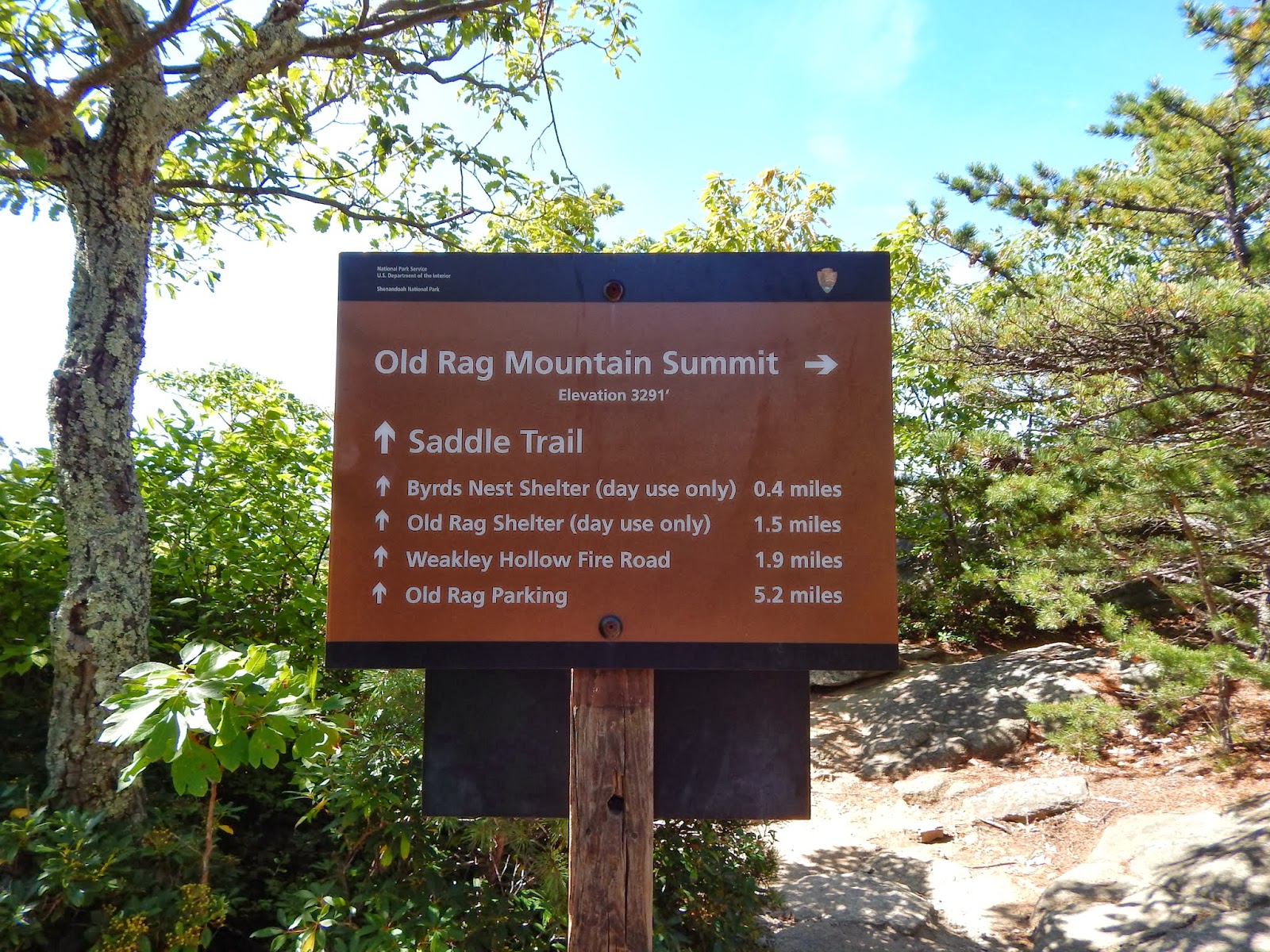


From here, as the sign tells you, you have 5.2 miles back to the parking lot.  Since it's all downhill, you'll have plenty of time to relax and contemplate the beauty you just witnessed.  It is a long, rocky 5 miles, however, so just make sure you have some good shoes.  My seven-year-old sneakers were literally falling apart, so my feet were a little sore by the end.  Still saving up to invest in a new pair of shoes...

Byrds Nest Shelter not far from the summit.  A little further on after this is the Old Rag Shelter, which has a compost toilet.

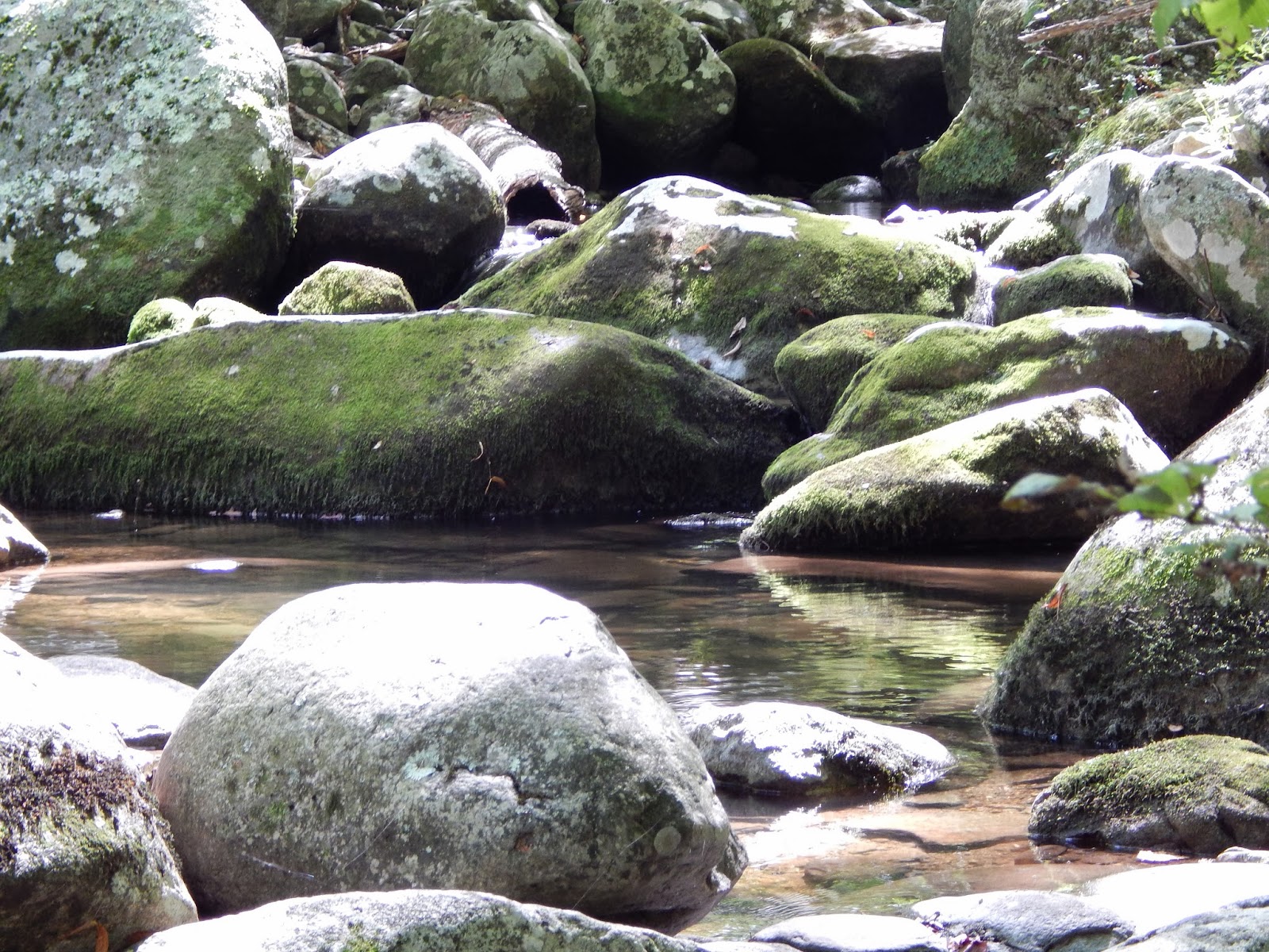
After coming to the Old Rag Shelter, turn right onto Weakly Hollow Fire Road.  The water of Brokenback Run flows near the road about half way down.

Arrowhead micrathena.  It was my first time seeing one, so I was pretty psyched.

You're close to the road you came in on when you reach the bridge.

Once you reach the road you'll simply be retracing your steps back to the parking lot.  Locals sell drinks and snacks on this road on weekend afternoons if you were less-than-smart and didn't bring enough food or water.

As I hope you've concluded for yourself, Old Rag is a fantastic day hike.  I cannot recommend it highly enough.  Quite frankly, I should have done this years ago.  I hope you get a chance to go.

Enjoy your hike, and keep wandering.

Pinterest - Quotes to Hike By

Sunday, September 22, 2013

Stony Man Trail

Location: Shenandoah National Park, Virginia
Season Visited: Summer
Trail Length: 1.6 miles
Time to Hike: 1 hour
Difficulty Level: 2

Stony Man trail is a short, moderately easy hike in the Skyland Area of Shenandoah National Park.  Perfect for when you're running short on time but still want to get in a worthwhile hike with fantastic views, the trail offers a great look-out point on a rocky promontory high above the valley.

Begin your hike at the Skyland parking area between mile markers 41 and 42.  The trailhead is well marked, and guidebooks are for sale here for $1.00 (using the honor system).  Along the way are marked signs that correspond to entries in the guidebook.

Wildflower along the trail.

After walking for about 15 minutes you come to a crossroads, as shown on this map.  Simply continue up the hill in front of you, passing by the Appalachian Trail, which continues north to your right.

Begin a gradual uphill climb just past the crossroads.

This hill continues onwards until you come to fork in the trail, which is the beginning of the small loop near the Stony Man summit.  Veer to the right to continue in the direction of the numbers in the guidebook.  This will take you past various interesting rock formations before depositing you at the summit where you'll find spectacular views of the valley below.

Lovely trees and boulders before the summit.

All the views you would expect from a 4,010 ft. summit - with none of the work!


When you've finished taking in the views, head back down the loop to the fork, and then retrace your steps to the parking area.  And that's it!

All in all, Stony Man is such a short, easy hike that I almost felt like I was cheating while taking pictures at the summit.  I chose this hike because it was past 4:00 after I had finished setting up camp at the nearby Big Meadows Campground, and I also wanted to save my strength for Old Rag the next day (look for that post next week!).  I'm very glad I went because the beauty is undeniable, and also because I now know a perfect hike for small children and non-hikers, if I'm ever at Shenandoah with such a group.  If you're at Shenandoah and want to have the experience of hiking to a spectacular view without putting in too much effort, then this is the perfect hike for you.

Enjoy it, and keep wandering.


Saturday, September 7, 2013

Sunfish Pond

Location: Worthington State Forest, Delaware Water Gap, New Jersey
Season Visited: Summer
Trail Length: 7.6 miles there-and-back
Time to Hike: 4.5 hours
Difficulty Level: 3

Sunfish Pond is a fascinating stop along the Appalachian Trial in northern New Jersey.  A beautiful pond created by a glacier, this lovely spot was declared a National Natural Landmark in 1970.  The trail there and back is a perfect half-day hike, and there are many options for extending the trip, including at least one loop and, of course, simply continuing on the AT.


Begin your hike at the Dunnfield Creek Natural Area parking lot and head straight to the AT, which is number 1 on this map.  Hike an easy gravel path until you come to the sign shown above, where you will be veering left at the fork to stay on the AT.  You will begin a steady uphill incline of 1000 feet in the next 3.7 miles.  It's perfectly manageable.


The trail looks mostly the same for the majority of the trip, but it never becomes boring.  The woods are gorgeous and peaceful.  On an absolutely perfect Friday in late summer when most people are still at work the trail is almost silent except for the sounds of birds and the wind in the trees.  Every time I got a little tired I sat on a rock and watched the sunlight play on the ferns and felt rejuvenated.

There is one very interesting place before you come to Backpacker Site #2 on the map, which is where the scenery starts to change a bit.  This is a rock garden filled with interesting little cairns.  There are several other cairns along the trail, but this is a particularly large gathering of them.  There are even more at the pond itself.

Cairns.

Once you hit Backpacker Site #2 be sure to stay to the right or you'll end up on the wrong trail.  The site itself is maintained by a national park ranger who keeps an eye on things.

The forest looks different here, right past the backpacker site.

Not long after this you come to the pond itself.  Take the AT past the NNL monument and enjoy exploring around the pond for a while.  Go right to the water's edge as slowly and quietly as possible and you will see more frogs than you can count.  There is also a wonderful little place to rest on some logs.


Pose at the pond.


Cairns across the water (cairns across the sky... nevermind).

Sean and Cleo taking a break.

So many frogs!

When you've rested up and taken in the beauty of the pond you can simply head back the way you came.  There is also the option of taking Dunnfield Hollow Trail.  I did not take this because of time constraints, but I would like to go back and do it this way at some point.  It is supposedly much more difficult and makes an 8.2-mile loop.  It also apparently has some lovely water cascades and a few stream fords.  I'll update this post if I ever take that way.

If you are so inclined, feel free to make a brief stop at the little waterfall where the AT intersects with the Blue Dot and Dunnfield Hollow trails, where you made the left turn in the beginning of your hike.  It's a nice way to end the day.


From here it's the same easy hike back to the parking lot.  Hopefully you have had a great time hiking.


Never stop wandering.


UPDATE - 11/5/13

Back in September I decided to take the 7.9-mile loop by connecting the Appalachian Trail and Dunnfield Creek Trail - and was so glad I did.  Although it only adds .3 miles to the trip, Dunnfield Creek Trail (or Dunnfield Hollow Trail, depending on the map you're using) adds a whole new dimension to the Sunfish Pond experience with quite different terrain.  It is extremely rocky and a bit more difficult than taking the AT back, but, as I said, is definitely worth it for the change in scenery.  I will strongly advise, however, that you do what I did and take the AT up and Dunnfield Creek back.  I pitied the few people I saw taking Dunnfield to the pond.  That would be quite an arduous trip.

The pond is absolutely beautiful in early fall.  The only thing I missed was the green of the ferns and the seemingly endless amount of frogs hopping around.  In late September, though, the trails have a charm of their own.  Here are a few pics of the AT up to the pond in September.


After taking the AT to the pond and enjoying the view, it's time to walk to the Dunnfield Creek Trail, which is clearly marked right past the pond.

Dunnfield Creek Trail to the right of the Sunfish Fire Road.  Cleo the amazing hiking yorkie-poo in the foreground.


The trail is immediately beautiful, and quite different from what you experienced on the AT.  Right past the bend pictured above is a short section of extremely closely-packed trees and shrubs, leaving only about a foot of breadth on the trail.  It is a very different feel from the open undergrowth of the ferns on the AT.  You then come out to an open section and get a sense of your elevation.


Beyond another ferny section and some relatively steep downhill hiking comes one of the highlights of this trail: Dunnfield Creek.  While really only a little trickle of water, it is enough to form some peaceful cascades that keep you company while you hike.  There are a few nice places to sit amongst the rocks.  Keep in mind that there are also a number of places where you will need to cross back and forth across the creek on these rocks.  It will be obvious where you need to cross.


This eventually leads you right back to where you started at the Appalachian Trail.  Take this back to where you parked and your hike is complete!

Hopefully you have enjoyed this update.  If you're going to Sunfish Pond I highly recommend taking this loop.  It adds a negligible amount of mileage and no extra time.  Keep on wandering!