Location: Adirondack Mountains, Essex County, New York
Season Visited: Summer
Trail Length: 8.8 miles there and back
Time to Hike: Six hours
Difficulty Level: 5
Adirondack Park is an absolutely
huge state park in northern New York. It's a hiker's dream, with over 2,000 miles of trails to explore. One of the most enticing regions of the park is the
Adirondack High Peaks, the 46(ish) peaks that are over 4,000 feet high. I decided to hike
Phelps Mountain, which is supposedly one of the "easier" high peaks at 4,160 feet. It was anything but easy, but it sure was beautiful.
The hike begins at the
Adirondack Loj (actually the parking area right before the Loj). There is a $10 parking fee. Stop by the office once you've parked. There are friendly and knowledgeable staff that advise you on the changeable mountain weather and give you tips for hiking trails that you haven't done before. The trailhead is also used for
Mount Marcy, among other hikes, and enters the
High Peaks Wilderness Area.
Begin at the trailhead by the parking lot. The trails are very well marked. Be aware that the mileage listed to Phelps Mountain is only to where the ascent begins and doesn't include the actual climb up the mountain. Sean and I had originally been under the impression that the trail was 6.8 miles long, but it
is 8.8. Pace yourself. The mile up the mountain is absolutely brutal.
For a time you'll simply be walking in the woods, and it will be moderately easy. You'll come to a boardwalk. There are many small boards along the way, but this is an all-out boardwalk. Enjoy the ease - while you can...
Also enjoy being in Middle Earth!
There are many gorgeous streams and little cascades along the way if you veer slightly off the trail. I recommend stopping at them to rest and take pictures. Some would make great swimming areas, but remember that this is mountain water. It's freezing!
There are lots of cute frogs and toads around here.
Sean resting on the rocks.
After a while you will come to one of the highlights of the hike -
Marcy Dam.
Cross the water bridge to continue on your journey.
After the dam is a registration station. You should be sure to register, especially if you're in a small group. The mountain club sends out rescues for hikers who don't return.
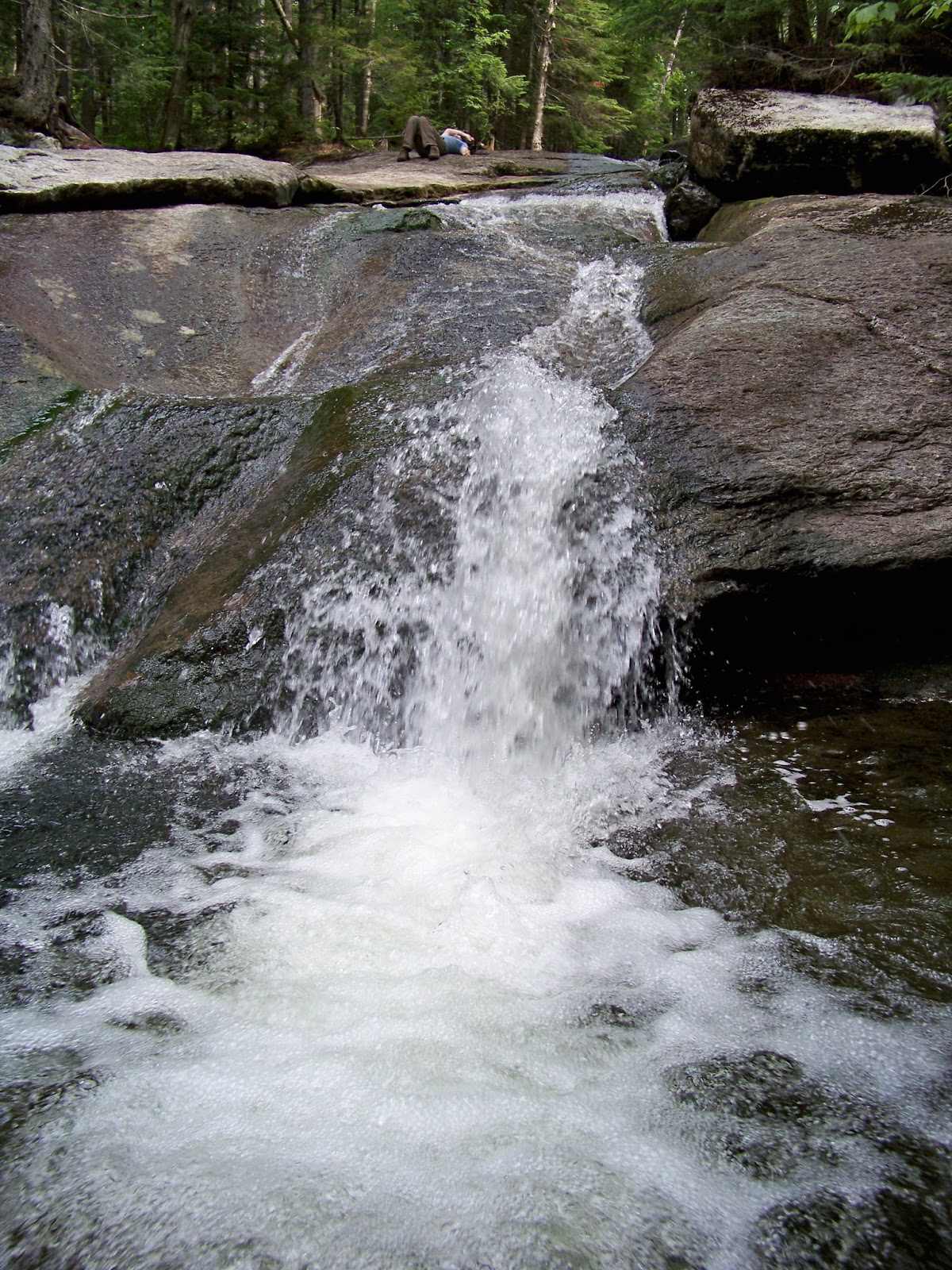
After some more deep woods hiking you'll come to High Water Bridge and its little waterfall. I should also mention that between Marcy Dam and High Water Bridge you will have to do a stream crossing. There are plenty of rocks to cross on, and we went right after a torrential rainstorm, so you don't need to worry about actually getting wet. Just be aware that this moment does come.
High Water Bridge.
Continue on your hike until you come to this sign:

At this point you have hiked 3.4 miles. I highly suggest mentally preparing yourself for the mile to come. It is, without question, the most difficult mile I have ever hiked. We saw about five other groups on our hike, and everyone agreed - this section of the trail might technically be one mile, but it feels like five. It is an arduous uphill climb. And yes, it is a climb. Almost the entire mile is made of rock scrambles. Since, as I mentioned earlier, we went right after a downpour that lasted several days (and actually continued after our hike), we were also climbing little slippery waterfalls. I advise you to be prepared for these conditions. Oh, and one other thing - BRING BUG SPRAY. The bugs became a joke amongst the hikers we saw, but it was more of a laugh-or-you-are-going-to-cry thing. I'm against that hardcore DEET stuff just like every other intelligent person on the planet, but there's a reason they're still making it. This is one occasion where you'll need it. Trust me.
The climb up Phelps Mountain was so difficult that I really didn't have the time (or willpower) to take pictures of all the wonderful rock scrambles. Here's what I did get, though.
The trail at this point is really just rocks.
One of the more mild rock scrambles at the bottom, before I stopped taking pictures of them.
Resistance to the water was futile.
Clintonia at a break point.
Remember how I said to mentally prepare yourself? I said this not only because of the physical difficulty of the trail, but because this mile seems to go on forever. You get to the point where you realize you're really high up and start getting the first of the spectacular views to come. You think to yourself, "Wow, I'm almost to the summit!" And then you continue to think this for the next hour. I would hazard a guess that the first four or five times you think you're almost there you actually aren't. Fortunately, the views keep tempting you to climb higher...
You're about 20 minutes from the summit when you hit this view.
There is an excellent photo spot only 5 minutes from the summit. It's a little less buggy than the very top, but you really can't beat the views from the summit itself. After all of your hard work, you deserve to soak in the splendor.
It's almost impossible to avoid the mud in the trails near the summit if you've been hiking after rain.
Don't forget the photos!
Obviously, the views of the surrounding high peaks are beyond spectacular. Are they worth the climb? Absolutely. Unfortunately, hiking in June means you might not be able to relax at the summit due to the bugs. Lucky for you, the climb down the mountain is much easier than the climb up it. Just be wary of slippery rocks. I did fall more than once.
You are bound to be pretty exhausted after your journey down the mountain. Stop at a creek to rest. You can actually take a little nap by the running water without getting eaten alive.
The walk back is mostly pleasant, depending on your stamina. Since I don't get to hike something this intense more than once a year or so, I was pretty much out of all the stamina I possess about two miles from the parking lot. I walked those last couple miles feeling like a zombie. Fortunately, someone was encouraging me.

About a mile after this sweet but spelling-challenged mushroom, the end is in sight. Even with our frequent breaks, we made it through the hike in exactly six hours, having started at 10:30 and ended at 4:30. For reference, it was only about noon when we got to the Phelps Mountain sign, so that's how much longer it took us to complete that section and then return. Half of the time spent on our 8.8 mile hike was spent on the 2 miles of Phelps alone. In the end, of course, every bead of sweat (and there were a lot of them) is worth it. This hike is invigorating and gorgeous, and certainly doesn't lack adventure. When you're finished, you'll get the honor of saying that you have hiked one of the 46 high peaks! Perhaps you'll even be on your way to becoming a
46er. Enjoy your hike, and keep wandering!


