Season Visited: Spring
Trail Length: 3-mile loop
Time to Hike: Two and a half hours
Difficulty Level: 3
French Creek State Park is a spacious park popular with those living in the Philadelphia area. From my home in Pennsville, NJ it's about an hour and 45 minutes away, so it's only a little more than an hour from Philly. The park features 35 miles of trails used for hiking, mountain biking, and horseback riding. The trails are well-kept, but, as you will see, are not well-marked on the map. You have been warned.
Having about four hours to hike, I decided to go with Turtle Trail based on its description on the park's website. The mileage and difficulty level sounded like what I wanted to get into, so I stopped at the park office on arrival (we came in on South Entrance Road from Route 345) and asked how to access Turtle Trail. The lady at the desk told me to park at Hopewell Lake, and then take Boone Trail to connect with Horseshoe Trail, which would lead me to Turtle Trail. I left and related this information to my sister and her boyfriend, my hiking companions for the day (along with my dog).
We began at Boone Trail, which we accessed from Park Road by Hopewell Lake. We came to the fork in the trail indicated by the map, and here's where things first started to become confusing. The trail to the left was called Horseshoe Trail, while on the map it was called Turtle Trail. Not once on the trail itself did signs refer to the trail as Turtle Trail, but it appears that they are one-in-the-same for at least part of the trail. We spent some time on this trail before deciding that we wanted to see the Hopewell Fire Tower, so we began looking out for Ridge Trail. Here are some images of our time on Turtle/Horseshoe Trail.
After some confusion due to unlabelled turn-offs and such, we made it to the intersection of Ridge and Horseshoe Trail. When you come to this on your own hike, be aware that it is unclear what color blazes Ridge Trail is supposed to have. It turns out that the trail is a red-blazed trail instead of the yellow and white blazes that you have been following up to this point.
Upon following Ridge Trail we came to Fire Tower Road. Now on the map, it seems that you make a left on Fire Tower Road to continue following the trail and come to the fire tower. We went this way and followed it for some time with absolutely no sign of the trail or the fire tower. We decided to turn around and follow the road to the parking area on the map, and in this way we found the Hopewell Fire Tower. My advice? Just turn right on the road to begin with.
The Hopewell Fire Tower. Be aware that it is surrounded by a barb-wire fence, so you cannot climb it (much to our disappointment).
Buildings and a picnic area around the fire tower.
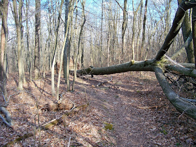
After a snack at the fire tower, we went to the end of the road (make a left when you come to the road after turning away from the fire tower) and connected back with Boone Trail. This brought us back to where we started, but not before bringing us to the Majestic Underpass and some other fun fallen trees.
All in all, our spur-of-the-moment combination of Boone, Horseshoe, and Ridge (and Turtle?) trails was a fun adventure. I can't say that this was one of my favorite hiking trips, but it was worth it. We only saw one other person our entire time on the trail, so visiting in early April seems to be great for solitude. If you live around French Creek, take advantage of it! Just be ready for some confusion with the map :)
Here is a video of our day's adventures. Enjoy your hike, and keep wandering.


No comments:
Post a Comment